Approximate Location Map
Large Map »
Latitude: 50.7581 / 50°45'29"N
Longitude: -1.5435 / 1°32'36"W
OS Eastings: 432292
OS Northings: 95492
OS Grid: SZ322954
Mapcode National: GBR 783.6LM
Mapcode Global: FRA 77N2.NGT
Plus Code: 9C2WQF54+7H
Entry Name: 75, High Street
Listing Date: 22 December 1953
Grade: II
Source: Historic England
Source ID: 1275243
English Heritage Legacy ID: 412858
ID on this website: 101275243
Location: Lymington, New Forest, Hampshire, SO41
County: Hampshire
District: New Forest
Civil Parish: Lymington and Pennington
Built-Up Area: Lymington
Traditional County: Hampshire
Lieutenancy Area (Ceremonial County): Hampshire
Church of England Parish: Lymington St Thomas the Apostle
Church of England Diocese: Winchester
Tagged with: Building
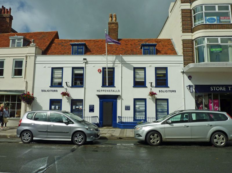
1.
5235 HIGH STREET
(North Side)
------------
No 75
SZ 3295 1/32 22.12.53.
II GV
2.
C18. Stuccoed facade with parapet and band below. 2 storeys and attic. 5 windows;
unbarred sashes with moulded flush frames.
Nos 70 to 75 (consec) form a group.
Listing NGR: SZ3229295492
External links are from the relevant listing authority and, where applicable, Wikidata. Wikidata IDs may be related buildings as well as this specific building. If you want to add or update a link, you will need to do so by editing the Wikidata entry.


Other nearby listed buildings
