Approximate Location Map
Large Map »
Latitude: 50.758 / 50°45'28"N
Longitude: -1.5441 / 1°32'38"W
OS Eastings: 432252
OS Northings: 95480
OS Grid: SZ322954
Mapcode National: GBR 783.DF5
Mapcode Global: FRA 77N2.N89
Plus Code: 9C2WQF54+69
Entry Name: 70, High Street
Listing Date: 28 October 1974
Grade: II
Source: Historic England
Source ID: 1275312
English Heritage Legacy ID: 412852
ID on this website: 101275312
Location: Lymington, New Forest, Hampshire, SO41
County: Hampshire
District: New Forest
Civil Parish: Lymington and Pennington
Built-Up Area: Lymington
Traditional County: Hampshire
Lieutenancy Area (Ceremonial County): Hampshire
Church of England Parish: Lymington St Thomas the Apostle
Church of England Diocese: Winchester
Tagged with: Building
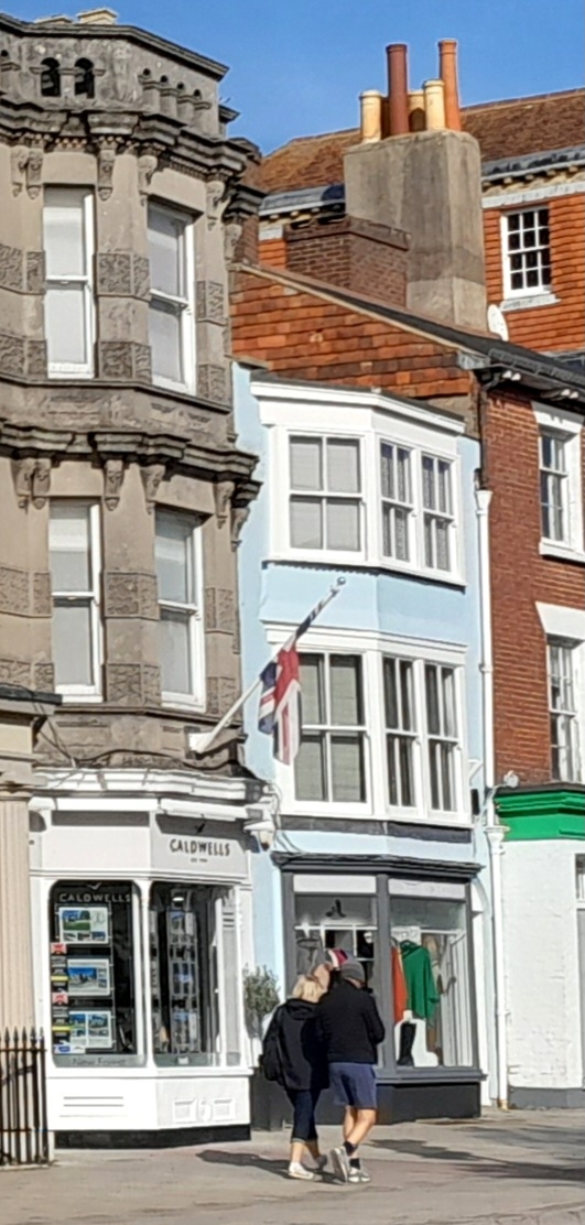
1.
5235 HIGH STREET
(North Side)
------------
No 70
SZ 3295 1/28
II GV
2.
C18. Stuccoed facade. 3 storeys, 1 window; canted bag of 4 sashes on all floors,
ground floor without glazing bars. Round arched door with stuccoed tympanum.
Nos 70 to 75 (consec) form a group.
Listing NGR: SZ3225295480
External links are from the relevant listing authority and, where applicable, Wikidata. Wikidata IDs may be related buildings as well as this specific building. If you want to add or update a link, you will need to do so by editing the Wikidata entry.


Other nearby listed buildings
