Latitude: 53.6017 / 53°36'5"N
Longitude: -1.9304 / 1°55'49"W
OS Eastings: 404702
OS Northings: 411679
OS Grid: SE047116
Mapcode National: GBR GVYS.WM
Mapcode Global: WHB91.BQ0R
Plus Code: 9C5WJ329+MR
Entry Name: Mellor Bridge
Listing Date: 25 May 1966
Last Amended: 11 July 1985
Grade: II*
Source: Historic England
Source ID: 1275335
English Heritage Legacy ID: 412803
ID on this website: 101275335
Location: Marsden, Kirklees, West Yorkshire, HD7
County: Kirklees
Electoral Ward/Division: Colne Valley
Parish: Non Civil Parish
Built-Up Area: Marsden
Traditional County: Yorkshire
Lieutenancy Area (Ceremonial County): West Yorkshire
Church of England Parish: Marsden St Bartholomew
Church of England Diocese: Leeds
Tagged with: Footbridge Packhorse bridge
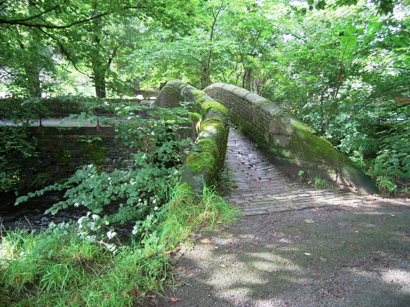
SE 0470 1168 MELLOR BRIDGE Marsden 14/308 Mellor Bridge (formerly 25.5.66 listed as Packhorse Bridge North of St Bartholomews Church)
GV II*
C17 or C18. Slender single span arched packhorse bridge over River Colne. Coursed rubble with rounded copings. Narrow walkway with good setted surface.
Listing NGR: SE0470211679
External links are from the relevant listing authority and, where applicable, Wikidata. Wikidata IDs may be related buildings as well as this specific building. If you want to add or update a link, you will need to do so by editing the Wikidata entry.


Other nearby listed buildings