Latitude: 51.182 / 51°10'55"N
Longitude: 0.9383 / 0°56'18"E
OS Eastings: 605457
OS Northings: 146638
OS Grid: TR054466
Mapcode National: GBR SXQ.XQ6
Mapcode Global: VHKKH.6KX6
Plus Code: 9F325WJQ+R8
Entry Name: Oxenturn House
Listing Date: 16 February 1989
Grade: II
Source: Historic England
Source ID: 1275364
English Heritage Legacy ID: 412650
ID on this website: 101275364
Location: Wye, Ashford, Kent, TN25
County: Kent
District: Ashford
Civil Parish: Wye with Hinxhill
Built-Up Area: Wye
Traditional County: Kent
Lieutenancy Area (Ceremonial County): Kent
Tagged with: School building
This list entry was subject to a Minor Amendment on 18 April 2024 to update the name and address and to amend description due to change in building use and reformat the text to current standards
TR 0446 0546
8/285
WYE
UPPER BRIDGE STREET
Oxenturn House
(Formerly listed as Wye High School, OXENTURN ROAD)
GV
II
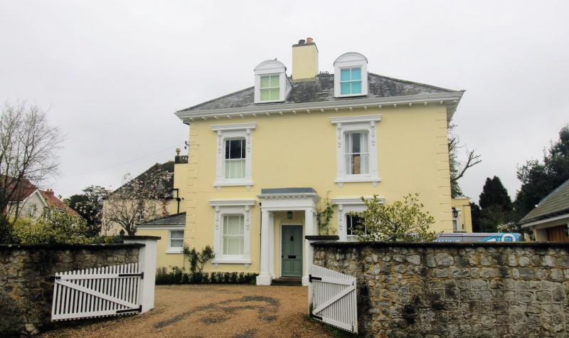
House, now school (at time of listing). Mid C19. Rendered with slate roof. Two storeys and attic on plinth with quoins and modillion bracketed eaves to hipped roof with two segmentally pedimented dormers and central stack. Two sashes on each floor with enriched pilastered surrounds with bracketed cills, and cornices on festooned lion-head brackets. Central door with two round headed panels in semi-circular surround with large Doric porch with modillion cornice and parapet. Bay window to right return (garden front). Left return with ground floor conservatory, and projecting rear wing with glazing bar sashes and pierced parapet with ball finials.
Listing NGR: TR0545746638
External links are from the relevant listing authority and, where applicable, Wikidata. Wikidata IDs may be related buildings as well as this specific building. If you want to add or update a link, you will need to do so by editing the Wikidata entry.


Other nearby listed buildings