Approximate Location Map
Large Map »
Latitude: 51.0017 / 51°0'6"N
Longitude: -0.7695 / 0°46'10"W
OS Eastings: 486437
OS Northings: 123198
OS Grid: SU864231
Mapcode National: GBR DDV.48D
Mapcode Global: FRA 968G.J24
Plus Code: 9C3X262J+M5
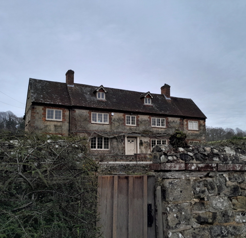
Entry Name: Stedham Mill House
Listing Date: 18 June 1959
Grade: II
Source: Historic England
Source ID: 1275503
English Heritage Legacy ID: 412088
ID on this website: 101275503
Location: Woolbeding, Chichester, West Sussex, GU29
County: West Sussex
District: Chichester
Civil Parish: Stedham with Iping
Built-Up Area: Stedham
Traditional County: Sussex
Lieutenancy Area (Ceremonial County): West Sussex
Church of England Parish: Stedham with Iping
Church of England Diocese: Chichester
Tagged with: House
STEDHAM WITH IPING MILL LANE
SU 82 SE
11/12 Stedham Mill House
18.6.59
- II
House. Late C18 or early C19. Red brick and stone with red brick dressings and
quoins. The end window-bays recessed. Tiled roof. Casement windows. Two
storeys and attic. Five windows. Two dormers. The mill building has been
demolished.
Listing NGR: SU8643723198
External links are from the relevant listing authority and, where applicable, Wikidata. Wikidata IDs may be related buildings as well as this specific building. If you want to add or update a link, you will need to do so by editing the Wikidata entry.


Other nearby listed buildings
