Approximate Location Map
Large Map »
Latitude: 51.3697 / 51°22'10"N
Longitude: 0.2149 / 0°12'53"E
OS Eastings: 554270
OS Northings: 165734
OS Grid: TQ542657
Mapcode National: GBR TT.JTS
Mapcode Global: VHHP6.NTYV
Plus Code: 9F329697+VW
Entry Name: Underberg
Listing Date: 1 August 1952
Last Amended: 22 October 1982
Grade: II
Source: Historic England
Source ID: 1275534
English Heritage Legacy ID: 411956
ID on this website: 101275534
Location: Eynsford, Sevenoaks, Kent, DA4
County: Kent
District: Sevenoaks
Civil Parish: Eynsford
Built-Up Area: Eynsford
Traditional County: Kent
Lieutenancy Area (Ceremonial County): Kent
Church of England Parish: Eynsford St Martin
Church of England Diocese: Rochester
Tagged with: Building
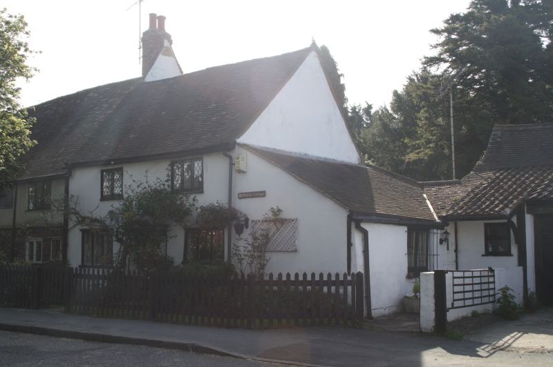
EYNSFORD HIGH STREET
1.
5280 (south-east side)
Underberg
(formerly listed as
The Ferns)
TQ 5465 12/47 1.8.52
II
GV
2.
C18 or earlier. Two storeys stuccoed. Tiled roof. Two casement windows.
Doorcase with flat weather hood on brackets.
Listing NGR: TQ5427065734
External links are from the relevant listing authority and, where applicable, Wikidata. Wikidata IDs may be related buildings as well as this specific building. If you want to add or update a link, you will need to do so by editing the Wikidata entry.


Other nearby listed buildings
