Approximate Location Map
Large Map »
Latitude: 52.2034 / 52°12'12"N
Longitude: -2.4262 / 2°25'34"W
OS Eastings: 370972
OS Northings: 256210
OS Grid: SO709562
Mapcode National: GBR FZ.36SW
Mapcode Global: VH851.WWR9
Plus Code: 9C4V6H3F+8G
Entry Name: Moors
Listing Date: 12 April 1973
Grade: II
Source: Historic England
Source ID: 1275605
English Heritage Legacy ID: 411799
ID on this website: 101275605
Location: County of Herefordshire, WR6
County: County of Herefordshire
Civil Parish: Whitbourne
Traditional County: Herefordshire
Lieutenancy Area (Ceremonial County): Herefordshire
Church of England Parish: Greater Whitbourne
Church of England Diocese: Hereford
Tagged with: Building
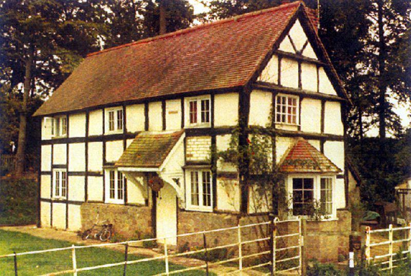
1.
1962 WHITBOURNE SAPEY BRIDGE
Moors
SO 75 NW 10/744
II
2.
C17 cottage Timber frame with painted brick nogging. Stone plinth.
Two storeys. Three windows, modern casements. Stall bay window on gable
end. Machine tile roof.
Listing NGR: SO7097256210
External links are from the relevant listing authority and, where applicable, Wikidata. Wikidata IDs may be related buildings as well as this specific building. If you want to add or update a link, you will need to do so by editing the Wikidata entry.


Other nearby listed buildings
