Approximate Location Map
Large Map »
Latitude: 51.5699 / 51°34'11"N
Longitude: -0.7734 / 0°46'24"W
OS Eastings: 485106
OS Northings: 186379
OS Grid: SU851863
Mapcode National: GBR D5W.H9K
Mapcode Global: VHDWB.JSZX
Plus Code: 9C3XH69G+WJ
Entry Name: Garden Wall and Gate Piers at Marlow Place
Listing Date: 31 January 1974
Grade: II
Source: Historic England
Source ID: 1275912
English Heritage Legacy ID: 410938
ID on this website: 101275912
Location: Marlow, Buckinghamshire, SL7
County: Buckinghamshire
Civil Parish: Marlow
Built-Up Area: Marlow
Traditional County: Buckinghamshire
Lieutenancy Area (Ceremonial County): Buckinghamshire
Church of England Parish: Great Marlow with Marlow Bottom, Little Marlow and Bisham
Church of England Diocese: Oxford
Tagged with: Wall
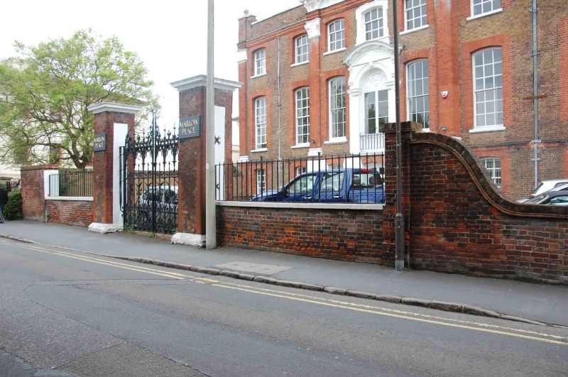
STATION ROAD
1.
l385
(North Side)
Garden wall and gate
piers at Marlow Place
SU 8586 1/54A
II
2.
Oil the South side running along Station Road a high brick wall which has
been lowered in front of the house to about 4 ft. 2 gate piers enclose
2 modern gates.
Listing NGR: SU8510686379
External links are from the relevant listing authority and, where applicable, Wikidata. Wikidata IDs may be related buildings as well as this specific building. If you want to add or update a link, you will need to do so by editing the Wikidata entry.


Other nearby listed buildings
