Latitude: 51.5724 / 51°34'20"N
Longitude: -0.7768 / 0°46'36"W
OS Eastings: 484869
OS Northings: 186661
OS Grid: SU848866
Mapcode National: GBR D5W.8G3
Mapcode Global: VHDWB.HQ6Y
Plus Code: 9C3XH6CF+X7
Entry Name: The Carpenters Arms Public House
Listing Date: 31 January 1974
Grade: II
Source: Historic England
Source ID: 1275926
English Heritage Legacy ID: 410857
ID on this website: 101275926
Location: Marlow, Buckinghamshire, SL7
County: Buckinghamshire
Civil Parish: Marlow
Built-Up Area: Marlow
Traditional County: Buckinghamshire
Lieutenancy Area (Ceremonial County): Buckinghamshire
Church of England Parish: Great Marlow with Marlow Bottom, Little Marlow and Bisham
Church of England Diocese: Oxford
Tagged with: Pub
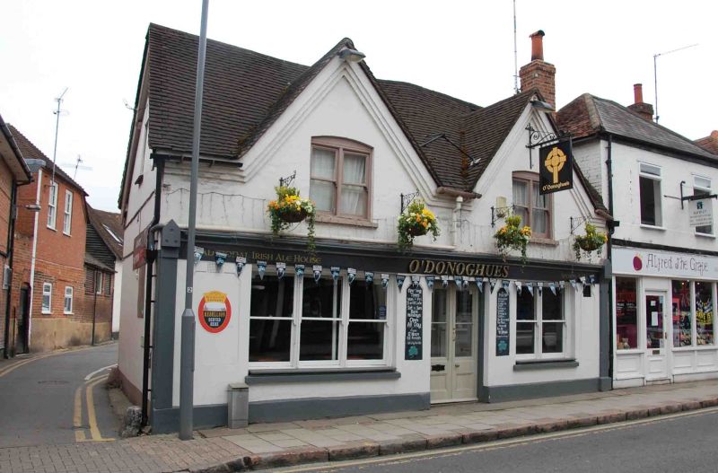
SPITTAL STREET
1.
1385
(North Side)
The Carpenters Arms
Public House
SU 8486 1/129
II
2.
C19 Public House. 2 storeys. Stucco. Gabled front elevation of 2 bays
and 2 windows. Sashes. Cornice and tile roof. C19 windows and door.
Listing NGR: SU8486986661
External links are from the relevant listing authority and, where applicable, Wikidata. Wikidata IDs may be related buildings as well as this specific building. If you want to add or update a link, you will need to do so by editing the Wikidata entry.


Other nearby listed buildings