Approximate Location Map
Large Map »
Latitude: 50.7842 / 50°47'3"N
Longitude: -1.1489 / 1°8'56"W
OS Eastings: 460092
OS Northings: 98642
OS Grid: SZ600986
Mapcode National: GBR 9BW.QBT
Mapcode Global: FRA 87H0.L6W
Plus Code: 9C2WQVM2+MC
Entry Name: Knapp Green
Listing Date: 12 February 1981
Grade: II
Source: Historic England
Source ID: 1276051
English Heritage Legacy ID: 409741
ID on this website: 101276051
Location: Alverstoke, Gosport, Hampshire, PO12
County: Hampshire
District: Gosport
Electoral Ward/Division: Alverstoke
Parish: Non Civil Parish
Built-Up Area: Gosport
Traditional County: Hampshire
Lieutenancy Area (Ceremonial County): Hampshire
Church of England Parish: Alverstoke St Mary
Church of England Diocese: Portsmouth
Tagged with: Architectural structure
VILLAGE ROAD
1.
5232
Alverstoke
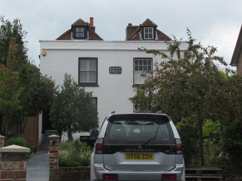
Nos 5 and 7
(Knapp Green)
SZ 6098 NW 9/117 12.2.81
II
2.
Circa 1830. Pair of Regency villas. Two-storeys, with semi-basement and attic.
1.1 windows. Hipped tile roofing. White painted walls with parapet. Sashes in
reveals. Steps lead to plain doorways.
Listing NGR: SZ6009698639
External links are from the relevant listing authority and, where applicable, Wikidata. Wikidata IDs may be related buildings as well as this specific building. If you want to add or update a link, you will need to do so by editing the Wikidata entry.


Other nearby listed buildings
