Latitude: 50.7951 / 50°47'42"N
Longitude: -1.1208 / 1°7'14"W
OS Eastings: 462064
OS Northings: 99867
OS Grid: SZ620998
Mapcode National: GBR VLB.36
Mapcode Global: FRA 86JZ.Z1B
Plus Code: 9C2WQVWH+2M
Entry Name: 109, High Street
Listing Date: 20 April 1983
Grade: II
Source: Historic England
Source ID: 1276565
English Heritage Legacy ID: 409010
ID on this website: 101276565
Location: Gosport, Hampshire, PO12
County: Hampshire
District: Gosport
Electoral Ward/Division: Town
Parish: Non Civil Parish
Built-Up Area: Gosport
Traditional County: Hampshire
Lieutenancy Area (Ceremonial County): Hampshire
Church of England Parish: Gosport Holy Trinity
Church of England Diocese: Portsmouth
Tagged with: Building
Terraced shop. Built in around the mid-C19. Later altered with a modern shopfront.
This list entry was subject to a Minor Enhancement on 29 February 2024 to amend the description and to add historic background
5232
SZ 6299 NW 8/67
HIGH STREET (south side) No 109
II
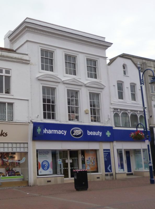
Terraced shop. Built in around the mid-C19 in classical style. Later altered with a modern shopfront.
MATERIALS: stuccoed brick to the front elevation.
DESCRIPTION: a three-storey building with a modern shopfront to the ground floor. There is a classical stucco facade with a fully moulded cornice and deep frieze. The sash windows are set in reveals and have moulded architraves. In addition, to the first floor, the central sash is covered by a triangular pediment and the outer sashes by segmental pediments.
Listing NGR: SZ6206199855
Gosport is recorded in 1206 as a ‘newly built’ port town. That which survives of the medieval grid pattern of streets and tenements is situated in what is now ‘Old Gosport’ and incorporates the east-west running High Street (‘Middle Street’ on C18 maps) which is flanked by North Street and South Street, with small cross streets and lanes (such as North Cross Street, South Cross Street and Bemister’s Lane) linking the three. By 1417, Gosport was involved in the defensive system of Portsmouth Harbour with a blockhouse (fort) on Blockhouse Point. A ferry service linked the two towns from the C16 onwards and the subsequent development of Gosport was largely driven by its role in defending the western landward and seaward approaches to the harbour and supplying the Royal Navy. From the late C17 onwards, a line of ramparts and artillery bastions, known as the Gosport Lines, were built surrounding the town. Gosport’s growth over the following three centuries mirrored that of the navy, as boatyards, rope-making facilities, victualling yards, a prison, hospitals, barracks and naval bases were constructed. It also led to demand for housing in large new residential areas beyond the Gosport Lines. During the Second World War, the town suffered major bomb damage and there was extensive post-war rebuilding after 1945.
109 High Street was built in around the mid-C19 on the south side of Gosport High Street.
External links are from the relevant listing authority and, where applicable, Wikidata. Wikidata IDs may be related buildings as well as this specific building. If you want to add or update a link, you will need to do so by editing the Wikidata entry.


Other nearby listed buildings