Latitude: 50.7951 / 50°47'42"N
Longitude: -1.125 / 1°7'29"W
OS Eastings: 461766
OS Northings: 99872
OS Grid: SZ617998
Mapcode National: GBR VKN.7Q
Mapcode Global: FRA 86JZ.X3W
Plus Code: 9C2WQVWG+32
Entry Name: 1, High Street
Listing Date: 25 August 1976
Grade: II
Source: Historic England
Source ID: 1276602
English Heritage Legacy ID: 409003
ID on this website: 101276602
Location: Gosport, Hampshire, PO12
County: Hampshire
District: Gosport
Electoral Ward/Division: Town
Parish: Non Civil Parish
Built-Up Area: Gosport
Traditional County: Hampshire
Lieutenancy Area (Ceremonial County): Hampshire
Church of England Parish: Gosport Holy Trinity
Church of England Diocese: Portsmouth
Tagged with: Building
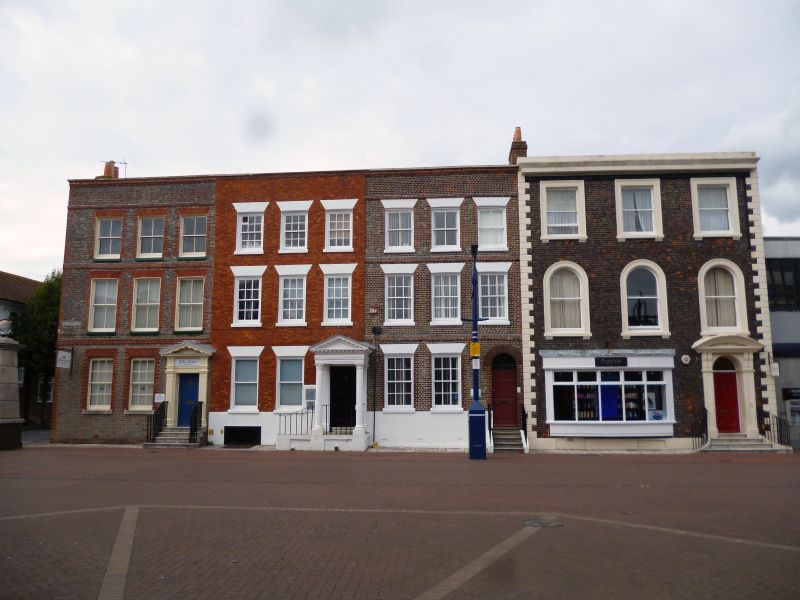
HIGH STREET
1.
5232
(north side)
No 1
SZ 6199 NE 7/60 25.8.76
II GV
2.
Late C18. 3-storeys, 3 windows. Painted brick facade with parapet. Sash windows.
Tile roof. Modern shop front to ground floor.
Listing NGR: SU5870301371
External links are from the relevant listing authority and, where applicable, Wikidata. Wikidata IDs may be related buildings as well as this specific building. If you want to add or update a link, you will need to do so by editing the Wikidata entry.


Other nearby listed buildings