Latitude: 54.7469 / 54°44'48"N
Longitude: -2.2091 / 2°12'32"W
OS Eastings: 386638
OS Northings: 539124
OS Grid: NY866391
Mapcode National: GBR FF0K.J4
Mapcode Global: WHB39.1YBB
Plus Code: 9C6VPQWR+Q9
Entry Name: Bridge over River Wear
Listing Date: 5 June 1987
Grade: II
Source: Historic England
Source ID: 1277160
English Heritage Legacy ID: 407620
Also known as: Blackdene Bridge
ID on this website: 101277160
Location: West Blackdene, County Durham, DL13
County: County Durham
Civil Parish: Stanhope
Traditional County: Durham
Lieutenancy Area (Ceremonial County): County Durham
Church of England Parish: St John's Chapel
Church of England Diocese: Durham
Tagged with: Bridge
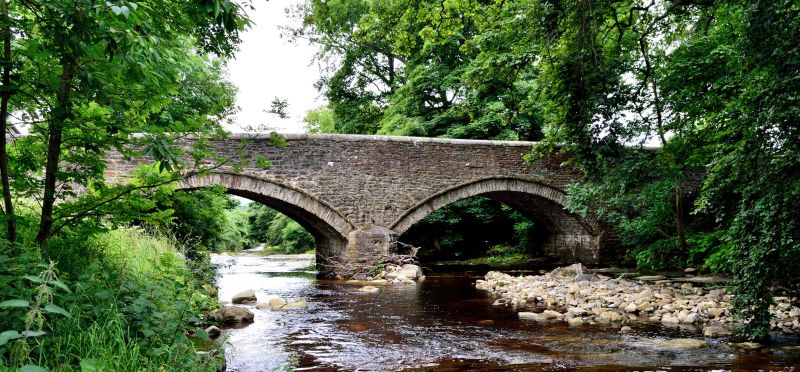
STANHOPE WEST BLACKDENE NY 83 NE 18/285 Bridge over River Wear GV II Bridge. Probably C18. Sandstone rubble with ashlar dressings. 2 wide segmental recessed arches, with narrow drip strings,flank cut water with low rounded coping. Parapets have round coping.
Listing NGR: NY8663839124
External links are from the relevant listing authority and, where applicable, Wikidata. Wikidata IDs may be related buildings as well as this specific building. If you want to add or update a link, you will need to do so by editing the Wikidata entry.


Other nearby listed buildings