Approximate Location Map
Large Map »
Latitude: 53.0676 / 53°4'3"N
Longitude: -2.5228 / 2°31'22"W
OS Eastings: 365065
OS Northings: 352395
OS Grid: SJ650523
Mapcode National: GBR 7S.BRQY
Mapcode Global: WH9BB.65X3
Plus Code: 9C5V3F9G+3V
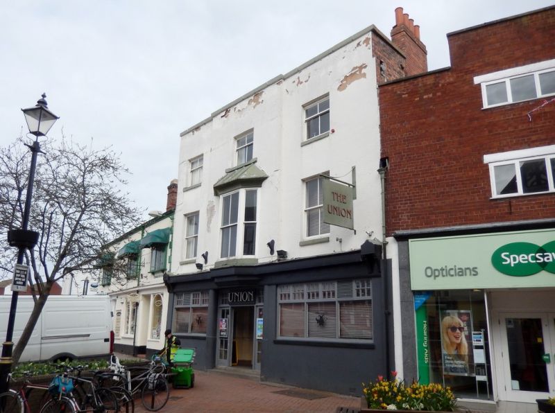
Entry Name: Union Inn
Listing Date: 1 March 1974
Grade: II
Source: Historic England
Source ID: 1277569
English Heritage Legacy ID: 431007
ID on this website: 101277569
Location: Snow Hill, Cheshire East, Cheshire, CW5
County: Cheshire East
Civil Parish: Nantwich
Built-Up Area: Nantwich
Traditional County: Cheshire
Lieutenancy Area (Ceremonial County): Cheshire
Church of England Parish: Nantwich St Mary
Church of England Diocese: Chester
Tagged with: Inn
1.
1425 HIGH STREET
(East Side)
-----------
Union Inn
SJ 6552 1/99
II
2.
Early C19. Engraved stucco; 3 storeys. Centre projects with a late Cl9 canted
bay window having lead pentice roof, 1 sash window each side (single glazing
bars); parapet. Modern inn front and alterations to ground storey.
Listing NGR: SJ6506952394
External links are from the relevant listing authority and, where applicable, Wikidata. Wikidata IDs may be related buildings as well as this specific building. If you want to add or update a link, you will need to do so by editing the Wikidata entry.


Other nearby listed buildings
