Latitude: 53.1099 / 53°6'35"N
Longitude: -1.5643 / 1°33'51"W
OS Eastings: 429266
OS Northings: 357051
OS Grid: SK292570
Mapcode National: GBR 599.1C5
Mapcode Global: WHCDV.Y397
Plus Code: 9C5W4C5P+W7
Entry Name: 30-46, Water Lane
Listing Date: 26 October 1972
Grade: II
Source: Historic England
Source ID: 1277986
English Heritage Legacy ID: 429814
ID on this website: 101277986
Location: Cromford, Derbyshire Dales, Derbyshire, DE4
County: Derbyshire
District: Derbyshire Dales
Civil Parish: Cromford
Built-Up Area: Cromford
Traditional County: Derbyshire
Lieutenancy Area (Ceremonial County): Derbyshire
Church of England Parish: Matlock Bath Holy Trinity
Church of England Diocese: Derby
Tagged with: Building
1. WATER LANE 1390 CROMFORD
Nos 30 to 46 (even) SK 2957 2/82
II
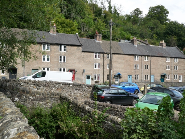
2. An early C19 tenement range. Coursed stone rubble; 3 storeys; 9 2-light mullioned windows mainly fitted with later casements; 9 simple doorways, Nos 32, 38, 44 and 46 with later gabled wood canopies on brackets; plain eaves; coped ends; old and new tiles. A plain range but visually important.
Listing NGR: SK2926657050
External links are from the relevant listing authority and, where applicable, Wikidata. Wikidata IDs may be related buildings as well as this specific building. If you want to add or update a link, you will need to do so by editing the Wikidata entry.


Other nearby listed buildings