Approximate Location Map
Large Map »
Latitude: 53.6446 / 53°38'40"N
Longitude: -1.7785 / 1°46'42"W
OS Eastings: 414741
OS Northings: 416482
OS Grid: SE147164
Mapcode National: GBR JV09.R7
Mapcode Global: WHCB1.NN99
Plus Code: 9C5WJ6VC+VJ
Entry Name: 43, Queensgate
Listing Date: 29 September 1978
Grade: II
Source: Historic England
Source ID: 1278112
English Heritage Legacy ID: 406608
ID on this website: 101278112
Location: Huddersfield, Kirklees, West Yorkshire, HD1
County: Kirklees
Electoral Ward/Division: Newsome
Parish: Non Civil Parish
Built-Up Area: Huddersfield
Traditional County: Yorkshire
Lieutenancy Area (Ceremonial County): West Yorkshire
Church of England Parish: Huddersfield St Peter
Church of England Diocese: Leeds
Tagged with: Building
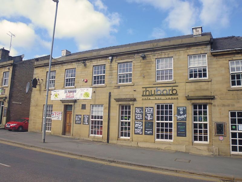
QUEENSGATE
1.
5113
(North Side)
No 43
SE 1416 SE 4/1129
II GV
2.
Early or mid C19. Ashlar. Pitched slate roof 2 storeys. Moulded eaves cornice.
Blocking course. 2 ranges of sashes with glazing bars. Door with fanlight
with glazing bars, in stone frame with entablature.
Listing NGR: SE1473716478
External links are from the relevant listing authority and, where applicable, Wikidata. Wikidata IDs may be related buildings as well as this specific building. If you want to add or update a link, you will need to do so by editing the Wikidata entry.


Other nearby listed buildings
