Approximate Location Map
Large Map »
Latitude: 54.711 / 54°42'39"N
Longitude: -1.9811 / 1°58'51"W
OS Eastings: 401315
OS Northings: 535105
OS Grid: NZ013351
Mapcode National: GBR GFLZ.W1
Mapcode Global: WHB3L.JVVC
Plus Code: 9C6WP269+9H
Entry Name: Lime Kiln West of Fine Burn Quarry
Listing Date: 5 June 1987
Grade: II
Source: Historic England
Source ID: 1278191
English Heritage Legacy ID: 406240
ID on this website: 101278191
Location: Hill End, County Durham, DL13
County: County Durham
Civil Parish: Stanhope
Traditional County: Durham
Lieutenancy Area (Ceremonial County): County Durham
Church of England Parish: Frosterley
Church of England Diocese: Durham
Tagged with: Lime kiln
STANHOPE BOLLIHOPE BURN
NZ 03 NW NZ 023351
(South bank)
21/159 Lime kiln west of
Fine Burn Quarry
II
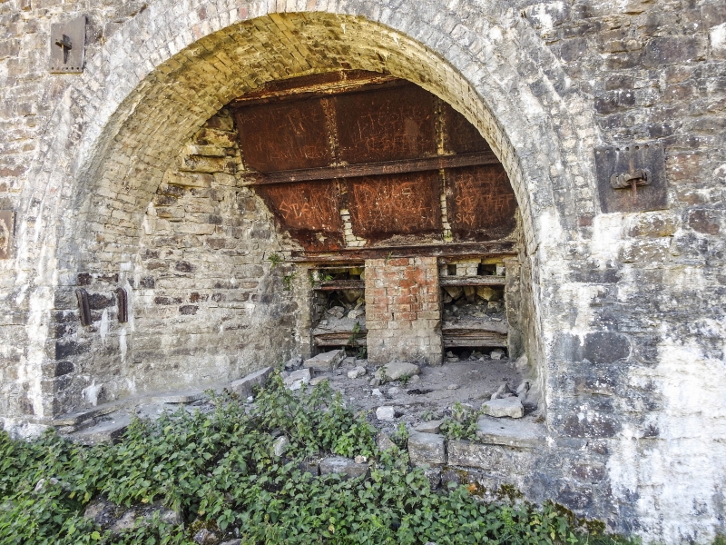
Limekilns. Probably early C19. Coursed sandstone rubble with yellow brick
dressings. Iron tie-rod ends. High retaining wall in 2 builds with segmental
arches of 4 rows of brick header courses. Interior of left kiln shows opening
from hopper and has brick column inserted.
Listing NGR: NZ0131535105
External links are from the relevant listing authority and, where applicable, Wikidata. Wikidata IDs may be related buildings as well as this specific building. If you want to add or update a link, you will need to do so by editing the Wikidata entry.


Other nearby listed buildings
