Approximate Location Map
Large Map »
Latitude: 54.7822 / 54°46'55"N
Longitude: -2.2714 / 2°16'17"W
OS Eastings: 382640
OS Northings: 543067
OS Grid: NY826430
Mapcode National: GBR DFL4.1H
Mapcode Global: WHB38.22N6
Plus Code: 9C6VQPJH+VC
Entry Name: Park Level Mine Bouse Teams
Listing Date: 5 June 1987
Grade: II
Source: Historic England
Source ID: 1278747
English Heritage Legacy ID: 404847
ID on this website: 101278747
Location: Killhope, County Durham, DL13
County: County Durham
Civil Parish: Stanhope
Traditional County: Durham
Lieutenancy Area (Ceremonial County): County Durham
Church of England Parish: Heatherycleugh
Church of England Diocese: Durham
Tagged with: Architectural structure
STANHOPE A689 (South side,off)
NY 84 SW
Killhope
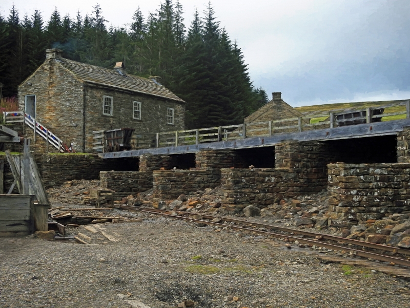
8/111 (inset) Park Level Mine
bouse teams
GV II
Bouse teams. Circa 1860 for Beaumont lead mining company. Sandstone rubble
with flat coping. 10 arch-plan enclosures, about one metre high, with lower
dividing walls.
Listing NGR: NY8264043067
External links are from the relevant listing authority and, where applicable, Wikidata. Wikidata IDs may be related buildings as well as this specific building. If you want to add or update a link, you will need to do so by editing the Wikidata entry.


Other nearby listed buildings
