Approximate Location Map
Large Map »
Latitude: 53.7187 / 53°43'7"N
Longitude: -2.063 / 2°3'46"W
OS Eastings: 395937
OS Northings: 424700
OS Grid: SD959247
Mapcode National: GBR GT1F.4P
Mapcode Global: WHB8D.8SVK
Plus Code: 9C5VPW9P+FQ
Entry Name: Rochdale Canal Lock 15 Shawplains Lock
Listing Date: 22 February 1984
Grade: II
Source: Historic England
Source ID: 1278952
English Heritage Legacy ID: 404596
ID on this website: 101278952
Location: Spring Side, Calderdale, West Yorkshire, OL14
County: Calderdale
Civil Parish: Todmorden
Traditional County: Yorkshire
Lieutenancy Area (Ceremonial County): West Yorkshire
Church of England Parish: Todmorden St Mary
Church of England Diocese: Leeds
Tagged with: Lock
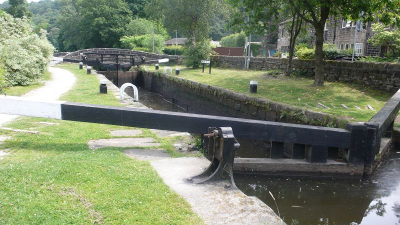
SD 92SE TODMORDEN (former M.B.) ROCHDALE CANAL
7/227 Lock 15,
(Shawplains Lock)
II
Lock. 1798. Large dressed stone retaining walls with rebates for gates.
Listing NGR: SD9593724700
External links are from the relevant listing authority and, where applicable, Wikidata. Wikidata IDs may be related buildings as well as this specific building. If you want to add or update a link, you will need to do so by editing the Wikidata entry.


Other nearby listed buildings
