Approximate Location Map
Large Map »
Latitude: 52.6617 / 52°39'42"N
Longitude: 0.1508 / 0°9'2"E
OS Eastings: 545557
OS Northings: 309281
OS Grid: TF455092
Mapcode National: GBR L1X.2Y5
Mapcode Global: WHJPH.9C19
Plus Code: 9F42M562+M8
Entry Name: Stable Block to North of Number 69
Listing Date: 31 October 1983
Grade: II
Source: Historic England
Source ID: 1279034
English Heritage Legacy ID: 48397
ID on this website: 101279034
Location: Wisbech, Fenland, Cambridgeshire, PE13
County: Cambridgeshire
District: Fenland
Civil Parish: Wisbech
Built-Up Area: Wisbech
Traditional County: Cambridgeshire
Lieutenancy Area (Ceremonial County): Cambridgeshire
Church of England Parish: Wisbech St Peter and St Paul
Church of England Diocese: Ely
Tagged with: Stable
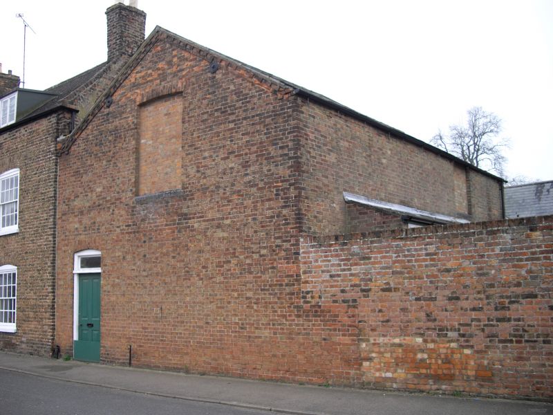
WISBECH NORTH BRINK
TF 4509
7/274 Stable block to
north of No. 69
GV II
Early to mid C19 stables. L-plan with gable to street and one
block sharing common wall with No. 69. Brown stock brick, and
gault brick with slate roofs. Boundary wall to street enclosing
yard has gate piers with stone ball finials.
Listing NGR: TF4555709281
External links are from the relevant listing authority and, where applicable, Wikidata. Wikidata IDs may be related buildings as well as this specific building. If you want to add or update a link, you will need to do so by editing the Wikidata entry.


Other nearby listed buildings
