Approximate Location Map
Large Map »
Latitude: 50.7119 / 50°42'42"N
Longitude: -2.7634 / 2°45'48"W
OS Eastings: 346196
OS Northings: 90526
OS Grid: SY461905
Mapcode National: GBR PP.1PNF
Mapcode Global: FRA 5736.78C
Plus Code: 9C2VP66P+PJ
Entry Name: The Old Salt House
Listing Date: 19 September 1975
Grade: II
Source: Historic England
Source ID: 1279419
English Heritage Legacy ID: 403407
ID on this website: 101279419
1.
5l91 WEST BAY
WEST OF WEST BAY ROAD
AND NORTH OF THE HARBOUR
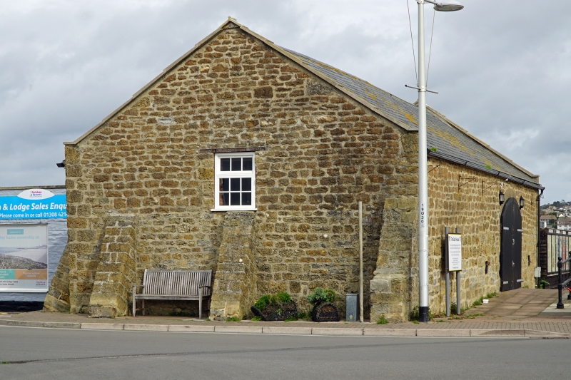
The Old Salt House
SY 4690 10/191
II
2.
C18 or C19. Hammer dressed stone. Pitched slate roof, with coped gable ends.
1 storey. Raked stone buttresses on south and west sides. Segment headed
opening on east side. Formerly used for manufacture of salt.
Listing NGR: SY4619690526
External links are from the relevant listing authority and, where applicable, Wikidata. Wikidata IDs may be related buildings as well as this specific building. If you want to add or update a link, you will need to do so by editing the Wikidata entry.


Other nearby listed buildings
