Latitude: 51.2678 / 51°16'4"N
Longitude: -0.3241 / 0°19'26"W
OS Eastings: 517012
OS Northings: 153404
OS Grid: TQ170534
Mapcode National: GBR HG4.GVP
Mapcode Global: VHGS1.BDHG
Plus Code: 9C3X7M9G+48
Entry Name: The Running Horses Inn
Listing Date: 28 November 1951
Grade: II
Source: Historic England
Source ID: 1279445
English Heritage Legacy ID: 289961
ID on this website: 101279445
Location: Mickleham, Mole Valley, Surrey, RH5
County: Surrey
District: Mole Valley
Civil Parish: Mickleham
Built-Up Area: Mickleham
Traditional County: Surrey
Lieutenancy Area (Ceremonial County): Surrey
Church of England Parish: Mickleham
Church of England Diocese: Guildford
Tagged with: Inn
LONDON ROAD, MICKIEHAM 1. 1049 The Running Horses Inn TQ 1653 8A/107 TQ 1753 8A/107 28.11.51.
II
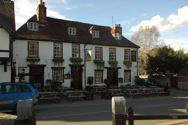
2. C18 coach and posting inn. 2 storeys and attic. 6 windows. 4 hipped dormers. Front painted brick, north side weatherboarded. Hipped tiled roof. Glazing bars intact. 3 doorways with pilasters, rectangular fanlight and projecting cornice, the centre one with a door of 6 fielded panels, the northernmost one in a trellised wooden porch. The entrance to the original stabling on the south side is now blocked with garage accommodation.
Listing NGR: TQ1701253404
External links are from the relevant listing authority and, where applicable, Wikidata. Wikidata IDs may be related buildings as well as this specific building. If you want to add or update a link, you will need to do so by editing the Wikidata entry.


Other nearby listed buildings