Latitude: 53.4215 / 53°25'17"N
Longitude: -2.2432 / 2°14'35"W
OS Eastings: 383934
OS Northings: 391664
OS Grid: SJ839916
Mapcode National: GBR DXSW.46
Mapcode Global: WHB9V.J81B
Plus Code: 9C5VCQC4+JP
Entry Name: Oak Bank
Listing Date: 3 October 1974
Grade: II
Source: Historic England
Source ID: 1279558
English Heritage Legacy ID: 387914
ID on this website: 101279558
Location: West Didsbury, Manchester, Greater Manchester, M20
County: Manchester
Electoral Ward/Division: Didsbury West
Parish: Non Civil Parish
Built-Up Area: Manchester
Traditional County: Lancashire
Lieutenancy Area (Ceremonial County): Greater Manchester
Church of England Parish: West Didsbury Christ Church and St Christopher Withington
Church of England Diocese: Manchester
Tagged with: Architectural structure
MANCHESTER
SJ89SW BARLOW MOOR ROAD, Barlow Moor 698-1/8/635 (North side) 03/10/74 Nos.112 AND 114 Oak Bank
II
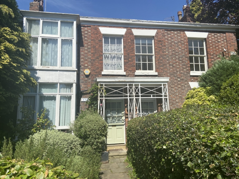
Pair of houses. Dated 1851; altered. Red brick in Flemish bond with some yellow headers, slate roof. Double-depth plan, each house single-fronted, built halls-adjoining. Two storeys, 2+2 windows, with slightly raised centre and corner pilasters, the walls between these of polychrome brickwork, plain frieze and moulded gutter cornice. The centre has a rectangular iron-latticed porch protecting panelled and glazed doors with overlights; the windows are mostly 12-pane sashes with raised sills and wedge lintels but No.114 to the left has an added 2-storey rectangular bay with large casements. Attached to right-hand corner of No.112 is an iron plaque lettered "OAK BANK / 1851". Slate-hung left gable. Gable chimneys. Rear and interior not inspected.
Listing NGR: SJ8393491664
External links are from the relevant listing authority and, where applicable, Wikidata. Wikidata IDs may be related buildings as well as this specific building. If you want to add or update a link, you will need to do so by editing the Wikidata entry.


Other nearby listed buildings