Latitude: 51.4535 / 51°27'12"N
Longitude: -2.5982 / 2°35'53"W
OS Eastings: 358530
OS Northings: 172896
OS Grid: ST585728
Mapcode National: GBR C7K.CS
Mapcode Global: VH88M.XQ9L
Plus Code: 9C3VFC32+CP
Entry Name: 19 and 20, St Augustines Parade
Listing Date: 20 March 1974
Grade: II
Source: Historic England
Source ID: 1280125
English Heritage Legacy ID: 380411
ID on this website: 101280125
Location: Bristol, BS1
County: City of Bristol
Electoral Ward/Division: Central
Parish: Non Civil Parish
Built-Up Area: Bristol
Traditional County: Gloucestershire
Lieutenancy Area (Ceremonial County): Bristol
Church of England Parish: Bristol St Stephen with St James and St John the Baptist with St Michael and St George
Church of England Diocese: Bristol
Tagged with: Building
BRISTOL
ST5872NE ST AUGUSTINE'S PARADE, Centre 901-1/16/642 (West side) 20/03/74 Nos.19 AND 20
GV II
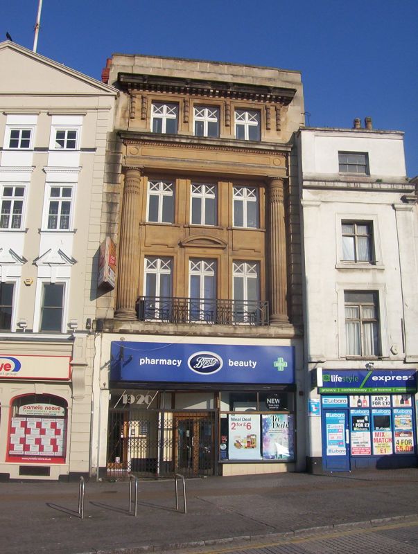
Offices. c1920. Limestone ashlar, roof not visible. Double-depth plan. Edwardian Neoclassical style. 3 storeys and attic; 3-window range. C20 shop front. Rusticated pilasters strips at the sides to the attic, with giant first- and second-floor fluted columns set inside them, with egg-and-dart capitals, to an overhanging panelled entablature and dentil cornice. Steel railings between the columns, beneath windows with architraves, segmental pediments to the central first-floor window, and plain raised aprons below second-floor windows. Attic has architraves, separated by hanging swag strips, a modillion cornice and parapet. INTERIOR: extensively remodelled; a right-hand stair.
Listing NGR: ST5853072896
External links are from the relevant listing authority and, where applicable, Wikidata. Wikidata IDs may be related buildings as well as this specific building. If you want to add or update a link, you will need to do so by editing the Wikidata entry.


Other nearby listed buildings