Latitude: 51.2464 / 51°14'46"N
Longitude: 0.3059 / 0°18'21"E
OS Eastings: 561037
OS Northings: 152214
OS Grid: TQ610522
Mapcode National: GBR NPT.S6K
Mapcode Global: VHHPV.8X2X
Plus Code: 9F3268W4+G9
Entry Name: Puttenden Manor Farmhouse
Listing Date: 25 August 1959
Grade: II
Source: Historic England
Source ID: 1280893
English Heritage Legacy ID: 357403
ID on this website: 101280893
Location: Dunk's Green, Tonbridge and Malling, Kent, TN11
County: Kent
District: Tonbridge and Malling
Civil Parish: Shipbourne
Traditional County: Kent
Lieutenancy Area (Ceremonial County): Kent
Church of England Parish: Shipbourne St Giles
Church of England Diocese: Rochester
Tagged with: Farmhouse
TQ 65 SW SHIPBOURNE PUTTENDEN ROAD 4/36 (east side)
25.8.59 Puttenden Manor Farmhouse GV II
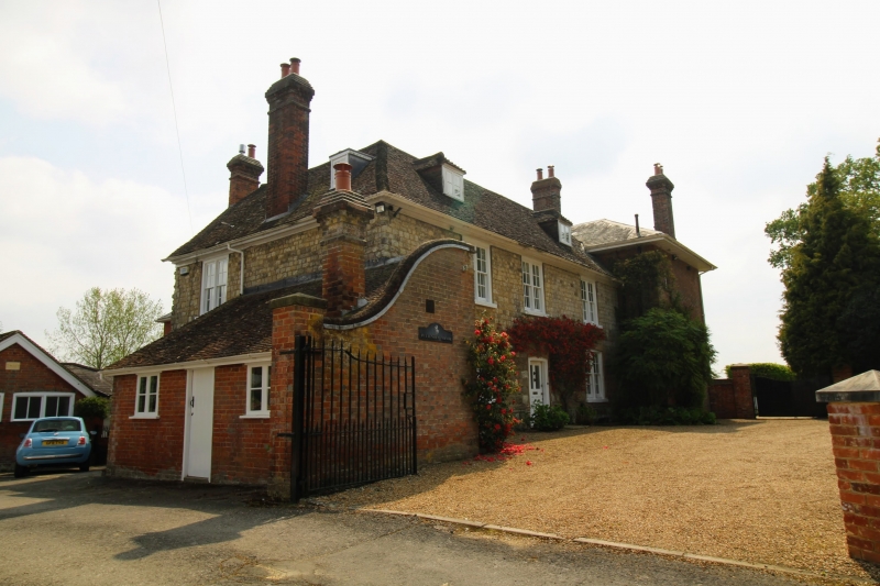
Farmhouse, formed by 2 buildings adjoining at right angles forming L-shaped plan. C18 front to west, mid-C19 to south. West front. Coursed stone blocks with flint galletting. Moulded eaves to plain tiled roof with 2 small hipped dormers. Two storeys and attic, 3 window front, coupled C19 glazing bar sashes, on the ground floor in rendered segment-head surrounds. Central half-glazed and panelled door in segment-head surround. South front. Red brick with wide flat projecting eaves and plaster soffit to hipped slate roof 2 storeys; 5 window front, glazing bar sashes. Central half-glazed and panelled door. Projecting columned porch with returned pilasters, panelled entablature and dentilled cornice.
Listing NGR: TQ6103752214
External links are from the relevant listing authority and, where applicable, Wikidata. Wikidata IDs may be related buildings as well as this specific building. If you want to add or update a link, you will need to do so by editing the Wikidata entry.


Other nearby listed buildings