Approximate Location Map
Large Map »
Latitude: 54.4878 / 54°29'15"N
Longitude: -0.6149 / 0°36'53"W
OS Eastings: 489827
OS Northings: 511152
OS Grid: NZ898111
Mapcode National: GBR SJ4K.P1
Mapcode Global: WHG9Y.JGFG
Plus Code: 9C6XF9QP+43
Entry Name: 5, Haggersgate
Listing Date: 4 December 1972
Grade: II
Source: Historic England
Source ID: 1281019
English Heritage Legacy ID: 326829
ID on this website: 101281019
Location: Whitby, North Yorkshire, YO21
County: North Yorkshire
District: Scarborough
Civil Parish: Whitby
Built-Up Area: Whitby
Traditional County: Yorkshire
Lieutenancy Area (Ceremonial County): North Yorkshire
Church of England Parish: Whitby St Mary
Church of England Diocese: York
Tagged with: Building
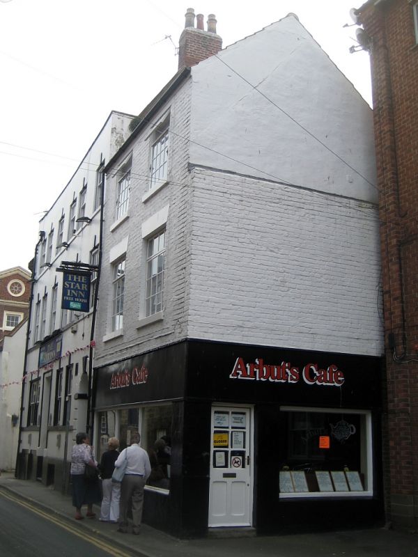
1.
1811 HAGGERSGATE
(West Side)
No 5
NZ 8911 1/381
II GV
2.
Probably early Cl9. 3 storeys in brick. 2 windows, rendered arches, double-hung
sashes with glazing bars. Mid-late C19 double shop front. Included for
group value.
No 5 and The Star Inn form a group.
Listing NGR: NZ8982711152
External links are from the relevant listing authority and, where applicable, Wikidata. Wikidata IDs may be related buildings as well as this specific building. If you want to add or update a link, you will need to do so by editing the Wikidata entry.


Other nearby listed buildings
