Latitude: 51.8374 / 51°50'14"N
Longitude: -0.0287 / 0°1'43"W
OS Eastings: 535913
OS Northings: 217261
OS Grid: TL359172
Mapcode National: GBR KB6.RKG
Mapcode Global: VHGPH.G25R
Plus Code: 9C3XRXPC+XG
Entry Name: The Windmill Public House
Listing Date: 30 September 1983
Grade: II
Source: Historic England
Source ID: 1281291
English Heritage Legacy ID: 356021
ID on this website: 101281291
Location: Wadesmill, East Hertfordshire, SG12
County: Hertfordshire
District: East Hertfordshire
Civil Parish: Thundridge
Built-Up Area: Thundridge
Traditional County: Hertfordshire
Lieutenancy Area (Ceremonial County): Hertfordshire
Tagged with: Pub
TL 3517
9/14
THUNDRIDGE
ERMINE STREET
(east side)
Thundridge
No 18 (The Windmill PH)
GV
II
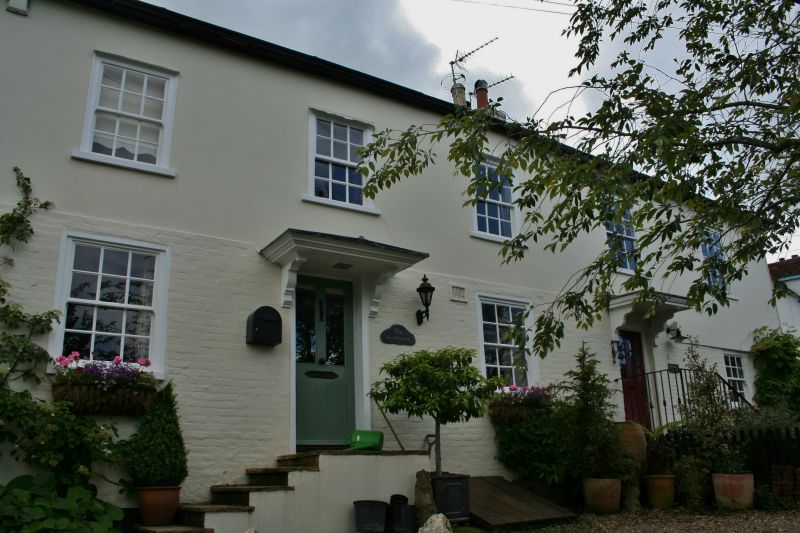
House, now a public house. Late C16 altered c1800. Timber frame
plastered with colourwashed brick ground floor and hipped slate
roof. 2-storeys building set on a bank above the road facing N.
Left half a former side-jettied end-chimney plan house has 3
steps up to central door. External gable chimneys forward of the
ridge, and winding stair in SE corner. Right half has lower
ground floor as former service rooms and coach house with
probably jettied accommodation over. Front wall raised and new
continuous hipped roof built c1800. Probably at same time the
jetties were underbuilt in brick and the present windows
inserted. 4-windows front with flush box sash windows with 6/6
panes. Half-glazed panelled door with moulded surround and flat
moulded hood on bold shaped brackets. Plain boarded door and
double doors in right hand half. Weatherboarded extension on W
end set back. Interior has moulded dado rail in E room, and
large fielded panelling, a cross of cased beams, a large open
fireplace, and the former front corner post with a portion of the
jetty-bearer still in place, in the W room. Important focal
building on axis looking S up the main street towards the church.
Listing NGR: TL3591317261
External links are from the relevant listing authority and, where applicable, Wikidata. Wikidata IDs may be related buildings as well as this specific building. If you want to add or update a link, you will need to do so by editing the Wikidata entry.


Other nearby listed buildings