Approximate Location Map
Large Map »
Latitude: 51.3891 / 51°23'20"N
Longitude: 1.3818 / 1°22'54"E
OS Eastings: 635381
OS Northings: 170991
OS Grid: TR353709
Mapcode National: GBR WZS.VK6
Mapcode Global: VHLG6.WBVY
Plus Code: 9F3399QJ+JP
Entry Name: 17, Market Place
Listing Date: 22 February 1973
Grade: II
Source: Historic England
Source ID: 1281473
English Heritage Legacy ID: 356628
ID on this website: 101281473
Location: Margate, Thanet, Kent, CT9
County: Kent
District: Thanet
Electoral Ward/Division: Margate Central
Parish: Non Civil Parish
Built-Up Area: Margate
Traditional County: Kent
Lieutenancy Area (Ceremonial County): Kent
Tagged with: Building
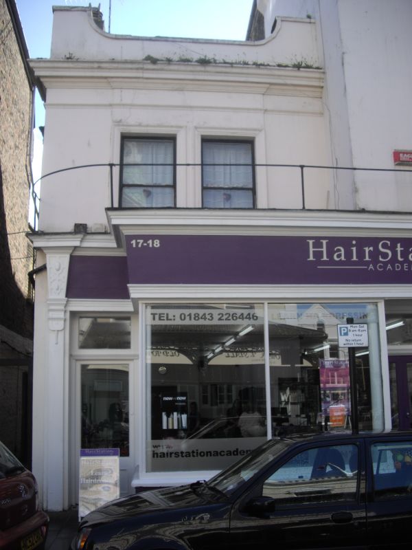
MARKET PLACE
1.
1380
(South Side)
No 17
TR 3570 NW 1/249
TR 3571 SW 2/249
II GV
2.
Mid C19. 2 storeys cement rendered. Parapet and dropped moulded eaves cornice.
2 sashes set in moulded architraves. Left side has a simple doorcase with
rectangular fanlight and later shopfront.
Nos 13 to 20 (consec) and No 1 Market Street form a group
Listing NGR: TR3538170991
External links are from the relevant listing authority and, where applicable, Wikidata. Wikidata IDs may be related buildings as well as this specific building. If you want to add or update a link, you will need to do so by editing the Wikidata entry.


Other nearby listed buildings
