Latitude: 50.4543 / 50°27'15"N
Longitude: -4.4637 / 4°27'49"W
OS Eastings: 225202
OS Northings: 64505
OS Grid: SX252645
Mapcode National: GBR NF.NR8M
Mapcode Global: FRA 17JV.JV0
Plus Code: 9C2QFG3P+PG
Entry Name: 11, Fore Street
Listing Date: 15 November 1993
Grade: II
Source: Historic England
Source ID: 1281820
English Heritage Legacy ID: 382189
ID on this website: 101281820
Location: Liskeard, Cornwall, PL14
County: Cornwall
Civil Parish: Liskeard
Built-Up Area: Liskeard
Traditional County: Cornwall
Lieutenancy Area (Ceremonial County): Cornwall
Church of England Parish: Liskeard
Church of England Diocese: Truro
Tagged with: Building
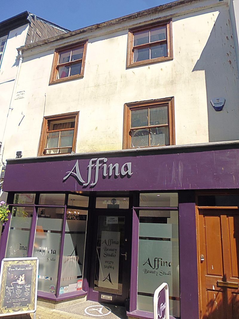
LISKEARD
SX2564 FORE STREET
979-1/5/100 (East side)
No.11
GV II
Town house, now with shop. Probably late C17, 1829 date plaque
with initials 'A.S.'. Incised stucco on studwork front;
asbestos slate roof. Deep plan. 3 storeys; 2-window range.
Late C19 four-pane horned sashes within moulded architraves;
C20 double shop front with projecting plate glass bays.
INTERIOR not inspected.
Listing NGR: SX2519964504
External links are from the relevant listing authority and, where applicable, Wikidata. Wikidata IDs may be related buildings as well as this specific building. If you want to add or update a link, you will need to do so by editing the Wikidata entry.


Other nearby listed buildings