Latitude: 50.5468 / 50°32'48"N
Longitude: -2.4409 / 2°26'27"W
OS Eastings: 368857
OS Northings: 71990
OS Grid: SY688719
Mapcode National: GBR PZ.3LXS
Mapcode Global: FRA 57SM.6WT
Plus Code: 9C2VGHW5+PJ
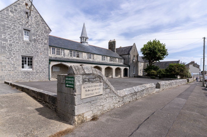
Entry Name: St George's Centre, Boundary Walls to South
Listing Date: 21 September 1978
Last Amended: 17 May 1993
Grade: II
Source: Historic England
Source ID: 1281830
English Heritage Legacy ID: 382020
ID on this website: 101281830
Location: Easton, Dorset, DT5
County: Dorset
Civil Parish: Portland
Built-Up Area: Weston
Traditional County: Dorset
Lieutenancy Area (Ceremonial County): Dorset
Church of England Parish: Portland All Saints
Church of England Diocese: Salisbury
Tagged with: Architectural structure
PORTLAND
SY6871 REFORNE, Easton 969-1/4/59 (North side) 21/09/78 St. George's Centre, boundary walls to S (Formerly Listed as: REFORNE Portland St George's County Infant School including Hall and Wall to road)
II
Boundary walls. Probably 1857, subsequently modified. Rubble with saddle back dressed coping. Walls run full width of the main building, and further 15m to the right; 3 return walls to face of the Centre. A plain trimmed opening opposite bay 2 of the arcade, and another opposite the gable to the right hand wing. Generally c 450mm high, but swept up at ends to c 1.5m. These walls appear to have been reduced in height since the previous listing, which describes them as 5ft (1.5m) throughout. Included for group value.
Listing NGR: SY6885771990
External links are from the relevant listing authority and, where applicable, Wikidata. Wikidata IDs may be related buildings as well as this specific building. If you want to add or update a link, you will need to do so by editing the Wikidata entry.


Other nearby listed buildings