Latitude: 51.4562 / 51°27'22"N
Longitude: -2.5827 / 2°34'57"W
OS Eastings: 359606
OS Northings: 173186
OS Grid: ST596731
Mapcode National: GBR CBJ.TV
Mapcode Global: VH88N.5NYJ
Plus Code: 9C3VFC48+FW
Entry Name: The Punchbowl Public House
Listing Date: 7 August 1972
Last Amended: 30 December 1994
Grade: II
Source: Historic England
Source ID: 1282192
English Heritage Legacy ID: 380043
ID on this website: 101282192
Location: Newtown, Bristol, BS2
County: City of Bristol
Electoral Ward/Division: Lawrence Hill
Parish: Non Civil Parish
Built-Up Area: Bristol
Traditional County: Gloucestershire
Lieutenancy Area (Ceremonial County): Bristol
Church of England Parish: Bristol St Philip and St Jacob with Emmanuel
Church of England Diocese: Bristol
Tagged with: Pub
BRISTOL
ST5973SE OLD MARKET STREET, Old Market 901-1/12/1636 (North side) 07/08/72 No.23 The Punchbowl Public House (Formerly Listed as: OLD MARKET STREET (North side) No.23)
GV II
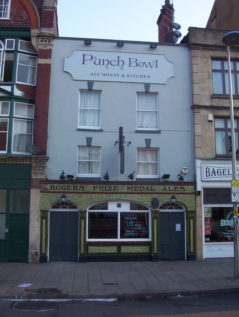
Public house. Mid C18, refronted early C19, late C19 public house front. Stucco with limestone dressings, brick right-hand lateral stack, and green glazed-tile ground floor. Double-depth plan. 3 storeys; 2-window range. A symmetrical parapeted front has elliptical-arched outer doorways with 6-pane fanlights and half-glazed double doors, and wider elliptical-arched central 2-light plate-glass window, with darker pilaster strips with reeded necks, and a fascia with brown glazed brick; low first-floor and taller second-floor windows with horned plate-glass sashes. INTERIOR: cross beams, that to the front chamfered with moulded stops; left-hand C20 stair.
Listing NGR: ST5960673186
External links are from the relevant listing authority and, where applicable, Wikidata. Wikidata IDs may be related buildings as well as this specific building. If you want to add or update a link, you will need to do so by editing the Wikidata entry.


Other nearby listed buildings