Latitude: 51.4347 / 51°26'4"N
Longitude: -2.5462 / 2°32'46"W
OS Eastings: 362124
OS Northings: 170771
OS Grid: ST621707
Mapcode National: GBR CLS.ZK
Mapcode Global: VH88V.T68J
Plus Code: 9C3VCFM3+VG
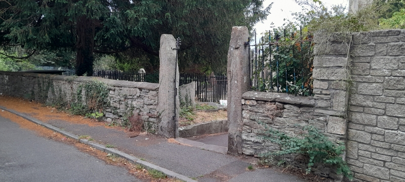
Entry Name: Boundary Wall, Piers and Railings to South East and South of Churchyard of Church of St Luke
Listing Date: 26 February 1987
Grade: II
Source: Historic England
Source ID: 1282351
English Heritage Legacy ID: 379147
ID on this website: 101282351
Location: St Luke's Church, Brislington, Bristol, BS4
County: City of Bristol
Electoral Ward/Division: Brislington East
Parish: Non Civil Parish
Built-Up Area: Bristol
Traditional County: Somerset
Lieutenancy Area (Ceremonial County): Bristol
Church of England Parish: Brislington St Luke
Church of England Diocese: Bristol
Tagged with: Wall
BRISTOL
ST6270 CHURCH HILL, Brislington 901-1/49/458 (North West side) 26/02/87 Boundary wall, piers and railings to SE & S of churchyard of Church of St Luke
GV II
Boundary wall, gates and railings. Mid to late C19. Pennant ashlar, rubble and cast-iron. Square, capped piers to the entrance to the churchyard, with gates. Flanking quadrant walls with saddleback coping, ramped up to the right. Beyond, a wall with cast-iron fleur-de-lys railings with stayed stanchions beside the footpath. The wall ends in a pair of monolithic piers, with a cast-iron gate with dog bars and spear tops. To the right the wall continues for approx 1.5m.
Listing NGR: ST6212470771
External links are from the relevant listing authority and, where applicable, Wikidata. Wikidata IDs may be related buildings as well as this specific building. If you want to add or update a link, you will need to do so by editing the Wikidata entry.


Other nearby listed buildings