Latitude: 51.9959 / 51°59'45"N
Longitude: -2.1561 / 2°9'21"W
OS Eastings: 389378
OS Northings: 233062
OS Grid: SO893330
Mapcode National: GBR 1JK.V09
Mapcode Global: VH93T.L308
Plus Code: 9C3VXRWV+9H
Entry Name: Boundary Walls and Gateway to Tudor Hotel
Listing Date: 27 July 1973
Last Amended: 25 April 1994
Grade: II
Source: Historic England
Source ID: 1282772
English Heritage Legacy ID: 376800
ID on this website: 101282772
Location: Tewkesbury, Gloucestershire, GL20
County: Gloucestershire
District: Tewkesbury
Civil Parish: Tewkesbury
Built-Up Area: Tewkesbury
Traditional County: Gloucestershire
Lieutenancy Area (Ceremonial County): Gloucestershire
Church of England Parish: Tewkesbury St Mary the Virgin (Tewkesbury Abbey)
Church of England Diocese: Gloucester
Tagged with: Wall
TEWKESBURY
SO8933 HIGH STREET 859-1/5/217 (West side) 27/07/73 Boundary walls and gateway to Tudor Hotel (Formerly Listed as: HIGH STREET (West side) Garden wall and gateway immediately to N of Tudor Hotel)
GV II
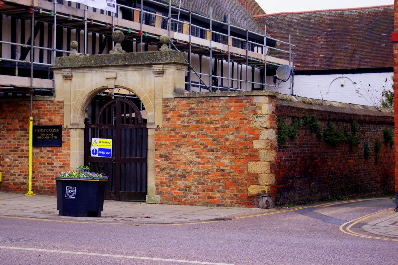
Boundary walls with gateway, gates and doors. Late C17 gateway, C18 and C20 rebuilt walls and gates. Brick with ashlar dressings. A short length of wall incorporating the gateway to High Street, and a longer return to Red Lane, enclosing a small courtyard to the north side of Tudor Hotel (qv). The High Street run in stretcher bond brickwork with flush stone quoins and approx 2.5m high, is set slightly forward from the main front of the Hotel. At its centre is a raised attic course in ashlar with thin cornice on 2 consoles, and a blocking course carrying 3 stone balls on pinnacles above an arched opening with central key, and on stone responds with caps. A pair of C20 wooden gates is set to the opening, with the dates 1540 and 1932; the latter representing the date of the restoration of the gateway. The longer return stretch to Red Lane is in English bond brickwork, probably of the early C18, rising to a maximum approx 3m height with a weathered and oversailing brick coping. There is a plank door adjoining the gable of the service block, and to its left an earlier opening, now blocked. There is a base course in single large stones for most of this length. A 1947 photograph in the NMR shows the gate set to all ashlar walling to High Street, with very worn stonework to the archway, and shrub overgrowth to the wall top. (National Monuments Record: 1947-).
Listing NGR: SO8937833062
External links are from the relevant listing authority and, where applicable, Wikidata. Wikidata IDs may be related buildings as well as this specific building. If you want to add or update a link, you will need to do so by editing the Wikidata entry.


Other nearby listed buildings