Latitude: 53.4803 / 53°28'49"N
Longitude: -2.2326 / 2°13'57"W
OS Eastings: 384657
OS Northings: 398205
OS Grid: SJ846982
Mapcode National: GBR DMH.7D
Mapcode Global: WHB9G.PS18
Plus Code: 9C5VFQJ8+4W
Entry Name: 68, Dale Street
Listing Date: 6 June 1994
Grade: II
Source: Historic England
Source ID: 1282972
English Heritage Legacy ID: 388076
ID on this website: 101282972
Location: Ancoats, Manchester, Greater Manchester, M1
County: Manchester
Electoral Ward/Division: City Centre
Parish: Non Civil Parish
Built-Up Area: Manchester
Traditional County: Lancashire
Lieutenancy Area (Ceremonial County): Greater Manchester
Church of England Parish: Manchester St Ann
Church of England Diocese: Manchester
Tagged with: Building
MANCHESTER
SJ8498SE DALE STREET 698-1/29/92 (West side) No.68
GV II
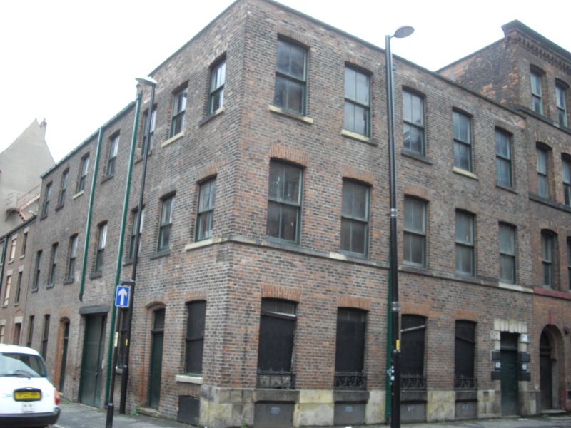
Small manufacturers' warehouse, now yarn merchant's. Probably mid C19. Red brick (possibly handmade) in English garden wall bond, with sandstone plinth, roof concealed by parapet. Basement and 3 storeys, 5-window front, with sill-band and rebuilt parapet; square-headed doorway at right-hand end with rusticated stone surround including keystone; segmental-headed 4-pane sashed windows with gauged brick heads. Left return wall (to Paton Street) has segmental-headed doorway in centre, and windows like those at the front. Probably one of the earliest warehouses in Dale Street. Included for group value.
Listing NGR: SJ8465798205
External links are from the relevant listing authority and, where applicable, Wikidata. Wikidata IDs may be related buildings as well as this specific building. If you want to add or update a link, you will need to do so by editing the Wikidata entry.


Other nearby listed buildings