Latitude: 51.6426 / 51°38'33"N
Longitude: -1.8551 / 1°51'18"W
OS Eastings: 410121
OS Northings: 193765
OS Grid: SU101937
Mapcode National: GBR 3RV.ZS9
Mapcode Global: VHB2Z.SZM5
Plus Code: 9C3WJ4VV+2X
Entry Name: 87 and 88, High Street
Listing Date: 25 August 1976
Grade: II
Source: Historic England
Source ID: 1284162
English Heritage Legacy ID: 317821
ID on this website: 101284162
Location: Cricklade, Wiltshire, SN6
County: Wiltshire
Civil Parish: Cricklade
Built-Up Area: Cricklade
Traditional County: Wiltshire
Lieutenancy Area (Ceremonial County): Wiltshire
Church of England Parish: Cricklade
Church of England Diocese: Bristol
Tagged with: Building
SU 19 SW CRICKLADE HIGH STREET (east side)
13/171 Nos. 87 and 88 25.8.76 GV II
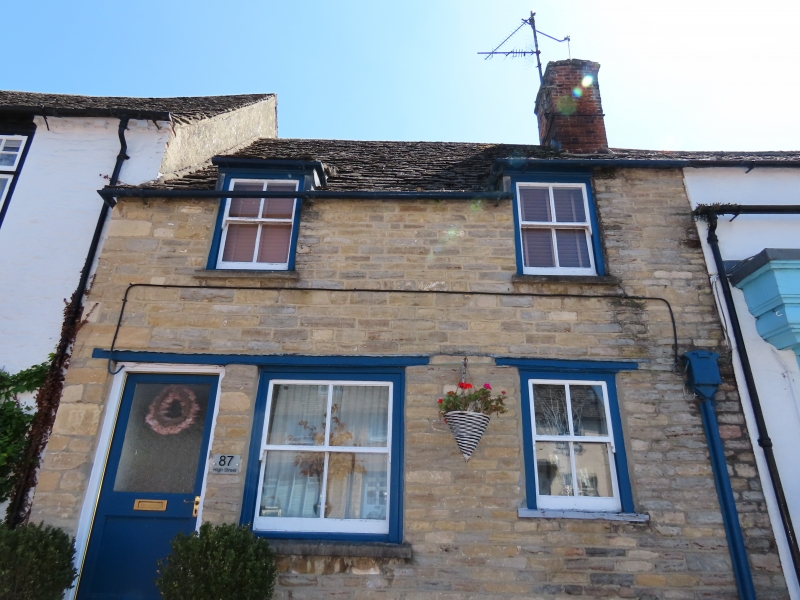
Pair of cottages in row. C17 or early C18. Limestone rubble, stone slate roof. Single storey and attic, each of 2 bays sharing central stack. No 87 has C20 door to left and two 4-pane sashes of different sizes to ground floor, with timber lintels. First floor also small 4-pane sashes with raked roofs. No 88 rendered and has ground floor shop windows with central door and fascia shared with No 89. Two first floor windows as No 87.
Listing NGR: SU1012393768
External links are from the relevant listing authority and, where applicable, Wikidata. Wikidata IDs may be related buildings as well as this specific building. If you want to add or update a link, you will need to do so by editing the Wikidata entry.


Other nearby listed buildings