Latitude: 51.6428 / 51°38'34"N
Longitude: -1.8554 / 1°51'19"W
OS Eastings: 410105
OS Northings: 193790
OS Grid: SU101937
Mapcode National: GBR 3RV.ZPN
Mapcode Global: VHB2Z.SYHZ
Plus Code: 9C3WJ4VV+4V
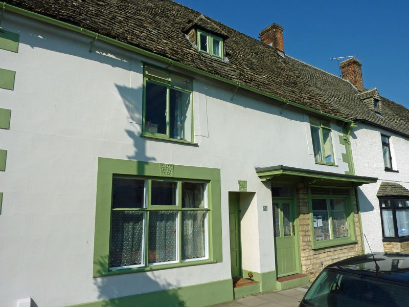
Entry Name: 53, High Street
Listing Date: 26 August 1976
Grade: II
Source: Historic England
Source ID: 1284228
English Heritage Legacy ID: 317791
ID on this website: 101284228
Location: Cricklade, Wiltshire, SN6
County: Wiltshire
Civil Parish: Cricklade
Built-Up Area: Cricklade
Traditional County: Wiltshire
Lieutenancy Area (Ceremonial County): Wiltshire
Church of England Parish: Cricklade
Church of England Diocese: Bristol
Tagged with: Building
SU 19 SW CRICKLADE HIGH STREET
(west side)
13/141 No. 53
26.8.76
GV II
House and shop. C18. Stucco with raised quoins. Stone slate
roof. Two storeys and attic, 3 bays. Half-glazed door to shop,
with perforated ventilator over shop window. C20 windows in raised-
architraves with vermiculated keys. Recessed C20 panelled door to
house. Central hipped dormer and left gable brick stack.
Listing NGR: SU1010093791
External links are from the relevant listing authority and, where applicable, Wikidata. Wikidata IDs may be related buildings as well as this specific building. If you want to add or update a link, you will need to do so by editing the Wikidata entry.


Other nearby listed buildings