Approximate Location Map
Large Map »
Latitude: 51.6249 / 51°37'29"N
Longitude: -1.4501 / 1°27'0"W
OS Eastings: 438159
OS Northings: 191934
OS Grid: SU381919
Mapcode National: GBR 6XS.05X
Mapcode Global: VHC0V.TF75
Plus Code: 9C3WJGFX+XW
Entry Name: Home Farmhouse
Listing Date: 6 December 1985
Grade: II
Source: Historic England
Source ID: 1284563
English Heritage Legacy ID: 251110
ID on this website: 101284563
Location: Denchworth, Vale of White Horse, Oxfordshire, OX12
County: Oxfordshire
District: Vale of White Horse
Civil Parish: Denchworth
Traditional County: Berkshire
Lieutenancy Area (Ceremonial County): Oxfordshire
Tagged with: Farmhouse
DENCHWORTH HYDE ROAD
SU39SE (West side)
1/16 Home Farmhouse
GV II
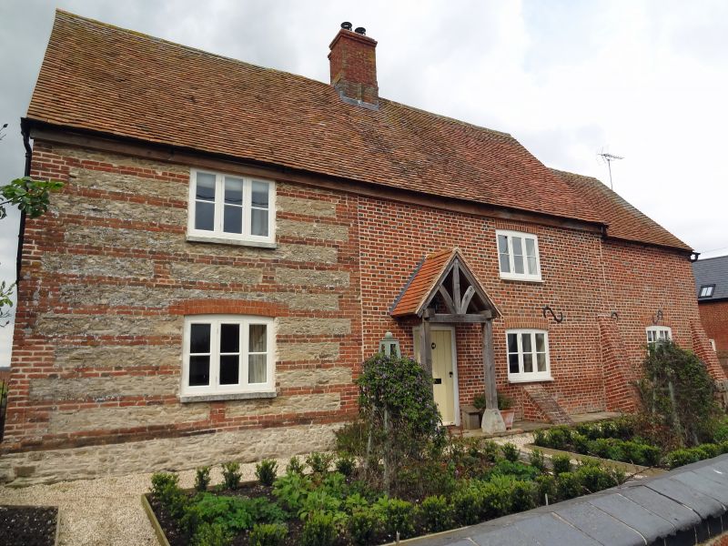
Farmhouse. Early C18 to right bay, later C18 left bay. Flemish bond brick with
flared headers to right; uncoursed limestone rubble with brick quoins and bands
to left; old tile roof; brick stack. 2-unit, lobby-entry plan. 2 storeys;
2-window range. Segmental arches over C20 door and casements. Gabled roof; ridge
stack. C18 two-storey, one-bay block to rear right was remodelled when late C19
bay added to rear. Interior: First floor and attic not inspected but likely to
be of interest.
Listing NGR: SU3815991934
External links are from the relevant listing authority and, where applicable, Wikidata. Wikidata IDs may be related buildings as well as this specific building. If you want to add or update a link, you will need to do so by editing the Wikidata entry.


Other nearby listed buildings
