Approximate Location Map
Large Map »
Latitude: 51.4893 / 51°29'21"N
Longitude: -1.8511 / 1°51'3"W
OS Eastings: 410434
OS Northings: 176711
OS Grid: SU104767
Mapcode National: GBR 3TT.DV9
Mapcode Global: VHB3R.VTRQ
Plus Code: 9C3WF4QX+PH
Entry Name: 142 and 143
Listing Date: 2 September 1986
Grade: II
Source: Historic England
Source ID: 1284653
English Heritage Legacy ID: 311280
ID on this website: 101284653
Location: Broad Hinton, Wiltshire, SN4
County: Wiltshire
Civil Parish: Broad Hinton
Built-Up Area: Broad Hinton
Traditional County: Wiltshire
Lieutenancy Area (Ceremonial County): Wiltshire
Tagged with: Building
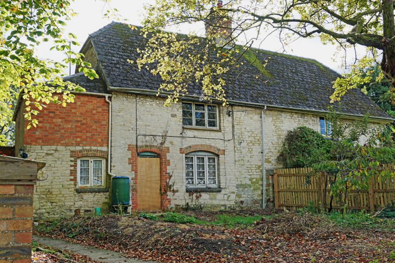
SU 17 NW BROAD HINTON VILLAGE CENTRE
(east side)
2/10 Nos 142 and 143
II
House and bakery, now two cottages. Late C18. Chalkstone, slate
roof replacing thatch c1920. Two storeys, 2 bays, lobby entry
plan with later extensions at both ends and at rear containing
entrances. Casement windows to first floor, tripartite timber
windows to ground floor with brick arched openings. Roof half
hipped. Central brick stack. No 143 formerly a bakery.
Listing NGR: SU1043476711
External links are from the relevant listing authority and, where applicable, Wikidata. Wikidata IDs may be related buildings as well as this specific building. If you want to add or update a link, you will need to do so by editing the Wikidata entry.


Other nearby listed buildings
