Approximate Location Map
Large Map »
Latitude: 51.6235 / 51°37'24"N
Longitude: -1.3241 / 1°19'26"W
OS Eastings: 446886
OS Northings: 191845
OS Grid: SU468918
Mapcode National: GBR 7Z8.221
Mapcode Global: VHCYD.0GC9
Plus Code: 9C3WJMFG+99
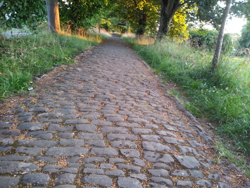
Entry Name: Raised Causeway
Listing Date: 19 February 1988
Grade: II*
Source: Historic England
Source ID: 1368076
English Heritage Legacy ID: 251365
ID on this website: 101368076
Location: Steventon, Vale of White Horse, Oxfordshire, OX13
County: Oxfordshire
District: Vale of White Horse
Civil Parish: Steventon
Built-Up Area: Steventon
Traditional County: Berkshire
Lieutenancy Area (Ceremonial County): Oxfordshire
Church of England Parish: Steventon
Church of England Diocese: Oxford
Tagged with: Causeway
STEVENTON THE CAUSEWAY
SU4691, SU4791 (North side)
12/58, 13/58 Raised Causeway
GV II*
Raised Causeway. Probably C14. Raised earthwork causeway with rubblestone
pathway and stone steps. History: probably built by the Black monks of
Steventon.
Buildings of England; Berkshire: 1975, p228; "The Oxford Village Book:", N.
Hammond, 1983, pl52).
Listing NGR: SU4683791820
External links are from the relevant listing authority and, where applicable, Wikidata. Wikidata IDs may be related buildings as well as this specific building. If you want to add or update a link, you will need to do so by editing the Wikidata entry.


Other nearby listed buildings
