Latitude: 53.5484 / 53°32'54"N
Longitude: -1.562 / 1°33'43"W
OS Eastings: 429119
OS Northings: 405838
OS Grid: SE291058
Mapcode National: GBR KWJD.MQ
Mapcode Global: WHCBQ.Z2CK
Plus Code: 9C5WGCXQ+96
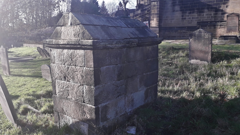
Entry Name: Tomb Approximately 10 Metres East of Chancel of Church of All Saints
Listing Date: 23 November 1987
Grade: II
Source: Historic England
Source ID: 1286158
English Heritage Legacy ID: 334293
ID on this website: 101286158
Location: All Saint's Church, Silkstone, Barnsley, South Yorkshire, S75
County: Barnsley
Civil Parish: Silkstone
Built-Up Area: Silkstone
Traditional County: Yorkshire
Lieutenancy Area (Ceremonial County): South Yorkshire
Church of England Parish: Silkstone All Saints
Church of England Diocese: Leeds
Tagged with: Tomb
SE 2906 SILKSTONE HIGH STREET (East side)
11/164 Tomb approx 10 metres east of chancel of Church of All Saints
GV II
Tomb. Probably C18. Deeply coursed gritstone. A simple rectangular structure with chamfered recessed panel in west end, and a pitched 2-course gritstone top an a moulded cornice.
Listing NGR: SE2911905838
External links are from the relevant listing authority and, where applicable, Wikidata. Wikidata IDs may be related buildings as well as this specific building. If you want to add or update a link, you will need to do so by editing the Wikidata entry.


Other nearby listed buildings