Latitude: 52.4099 / 52°24'35"N
Longitude: -0.6882 / 0°41'17"W
OS Eastings: 489325
OS Northings: 279912
OS Grid: SP893799
Mapcode National: GBR DX2.SZB
Mapcode Global: VHFNS.1P0D
Plus Code: 9C4XC856+XP
Entry Name: Village Hall
Listing Date: 19 June 1992
Grade: II
Source: Historic England
Source ID: 1286640
English Heritage Legacy ID: 231159
ID on this website: 101286640
Location: Warkton, North Northamptonshire, NN16
County: North Northamptonshire
Civil Parish: Warkton
Traditional County: Northamptonshire
Lieutenancy Area (Ceremonial County): Northamptonshire
Church of England Parish: Warkton St Edmund
Church of England Diocese: Peterborough
Tagged with: Village hall
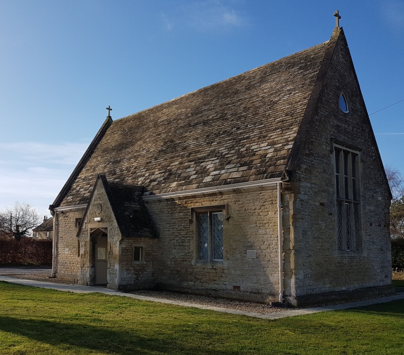
WARKTON SP8879 Village Hall 1337-0/17/191 GV IT School, now village hall. Dated 1867 on porch. Coursed limestone rubble with ashlar dressings, Collyweston stone slate roof. Coped gables with trefoil pattern to ends, cross finials and kneelers. Plain eaves cornice. Stack to rear. One storey. Central gabled porch has Tudor-arched entrance with spandrels carved with oak and ivy. Plain board door. 2-light stone mullioned window with hood-mould to either side. Each gable end has a lofty 3-light stone mullioned window with transom, and a spherical triangle window over. Lead lattice glazing. Wing to rear has gable to each side, a door with 4 flush panels in chamfered opening and trefoil above to north, a spherical triangle to west and a 2-light stone mullioned window with hood-mould to south.
Listing NGR: SP8932579912
External links are from the relevant listing authority and, where applicable, Wikidata. Wikidata IDs may be related buildings as well as this specific building. If you want to add or update a link, you will need to do so by editing the Wikidata entry.


Other nearby listed buildings