Latitude: 51.0628 / 51°3'46"N
Longitude: -0.3283 / 0°19'41"W
OS Eastings: 517242
OS Northings: 130606
OS Grid: TQ172306
Mapcode National: GBR HJN.7TS
Mapcode Global: FRA B669.V7R
Plus Code: 9C3X3M7C+4M
Entry Name: Former Lamb Inn
Listing Date: 26 July 1974
Grade: II
Source: Historic England
Source ID: 1287034
English Heritage Legacy ID: 298112
ID on this website: 101287034
Location: Horsham, West Sussex, RH12
County: West Sussex
District: Horsham
Electoral Ward/Division: Denne
Parish: Non Civil Parish
Built-Up Area: Horsham
Traditional County: Sussex
Lieutenancy Area (Ceremonial County): West Sussex
Church of England Parish: Horsham St Mary the Virgin
Church of England Diocese: Chichester
Tagged with: Inn
This list entry was subject to a Minor Amendment on 12 August 2025 to amend the name and address and to reformat the text to current standards
TQ 1730
1/34
CARFAX (Central Area)
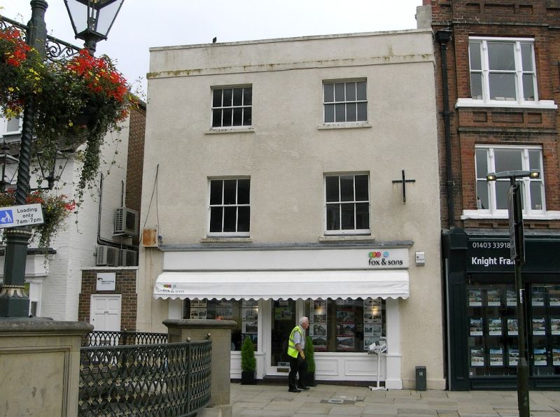
No 42, Former Lamb Inn
(Formerly listed as No 42 (The Lamb Inn))
II
Early C19. Two windows. Three storeys. Stuccoed. Cornice and parapet with stone capping. All sash windows, some glazing bars missing. Ground floor stringcourse. Square-headed doorway with narrow hood and moulded pilasters.
Listing NGR: TQ1724230606
External links are from the relevant listing authority and, where applicable, Wikidata. Wikidata IDs may be related buildings as well as this specific building. If you want to add or update a link, you will need to do so by editing the Wikidata entry.


Other nearby listed buildings