Latitude: 50.7347 / 50°44'4"N
Longitude: -2.7655 / 2°45'55"W
OS Eastings: 346074
OS Northings: 93062
OS Grid: SY460930
Mapcode National: GBR PP.0926
Mapcode Global: FRA 5734.DFY
Plus Code: 9C2VP6MM+VR
Entry Name: 20 and 22, West Allington
Listing Date: 19 September 1975
Grade: II
Source: Historic England
Source ID: 1287113
English Heritage Legacy ID: 403186
ID on this website: 101287113
Location: Allington, Dorset, DT6
County: Dorset
Civil Parish: Bridport
Built-Up Area: Bridport
Traditional County: Dorset
Lieutenancy Area (Ceremonial County): Dorset
Church of England Parish: Bridport St Mary
Church of England Diocese: Salisbury
Tagged with: Building
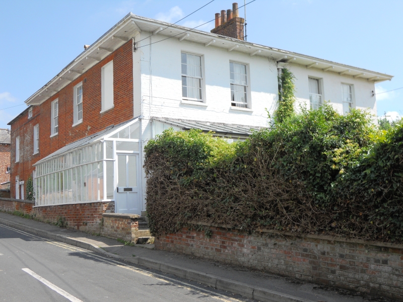
1.
5191 WEST ALLINGTON
(North Side)
SY 4693 2/15 Nos 20 & 22
II GV
2.
Early or mid C19. Whitewashed brick. Low-pitch hipped slate roof, wide eaves
with brackets. 2 storeys. Sashes with glazing bars. No 20 has original trellis
porch.
Nos 18 to 34 (even) form a group.
Listing NGR: SY4607993065
External links are from the relevant listing authority and, where applicable, Wikidata. Wikidata IDs may be related buildings as well as this specific building. If you want to add or update a link, you will need to do so by editing the Wikidata entry.


Other nearby listed buildings