Approximate Location Map
Large Map »
Latitude: 50.8617 / 50°51'41"N
Longitude: -2.3196 / 2°19'10"W
OS Eastings: 377605
OS Northings: 106954
OS Grid: ST776069
Mapcode National: GBR 0XR.VT6
Mapcode Global: FRA 661T.D5C
Plus Code: 9C2VVM6J+M5
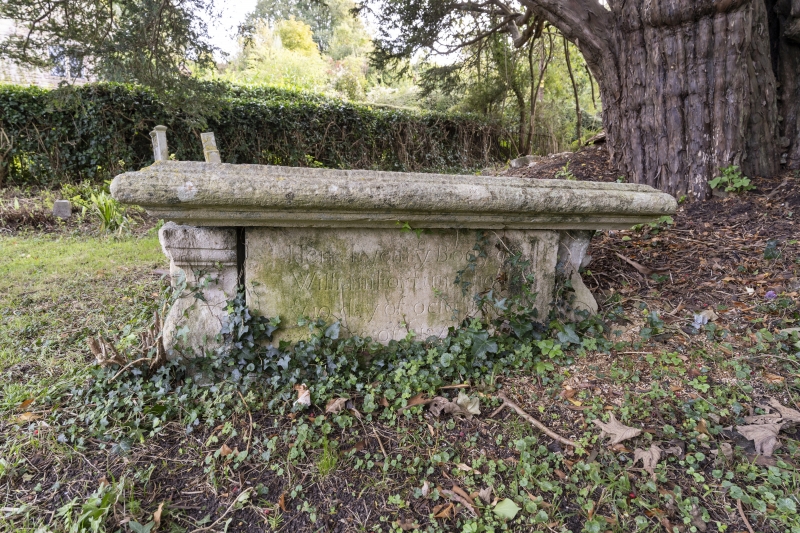
Entry Name: Table Tomb to William Fortun in Woolland Church Churchyard, Approximately 10 Metres South of Porch
Listing Date: 20 December 1983
Grade: II
Source: Historic England
Source ID: 1287175
English Heritage Legacy ID: 403098
ID on this website: 101287175
Location: Woolland, Dorset, DT11
County: Dorset
Civil Parish: Woolland
Traditional County: Dorset
Lieutenancy Area (Ceremonial County): Dorset
Church of England Parish: Woolland
Church of England Diocese: Salisbury
Tagged with: Tomb
WOOLLAND
ST 70 NE
9/202
Table Tomb to William
Fortun in Woolland
Church churchyard,
approximately 10 m
south of porch.
GV
II
Table tomb dated 1693. Stone with flat moulded top and baluster ends
bearing skull and crossbones and rose. "RCHM, Dorset, vol III", p 316,
no 1.
Listing NGR: ST7760506954
External links are from the relevant listing authority and, where applicable, Wikidata. Wikidata IDs may be related buildings as well as this specific building. If you want to add or update a link, you will need to do so by editing the Wikidata entry.


Other nearby listed buildings
