Approximate Location Map
Large Map »
Latitude: 50.6813 / 50°40'52"N
Longitude: -3.2429 / 3°14'34"W
OS Eastings: 312285
OS Northings: 87591
OS Grid: SY122875
Mapcode National: GBR P8.BRW4
Mapcode Global: FRA 4738.LFW
Plus Code: 9C2RMQJ4+GR
Entry Name: Larbi Cote
Listing Date: 12 November 1973
Grade: II
Source: Historic England
Source ID: 1287309
English Heritage Legacy ID: 402739
ID on this website: 101287309
Location: Sidmouth, East Devon, EX10
County: Devon
District: East Devon
Civil Parish: Sidmouth
Built-Up Area: Sidmouth
Traditional County: Devon
Lieutenancy Area (Ceremonial County): Devon
Church of England Parish: Sidmouth
Church of England Diocese: Exeter
Tagged with: Thatched cottage
STATION ROAD
1,
1633
(East Side)
Larbi Cote
SY 1287 1/129
II GV
2.
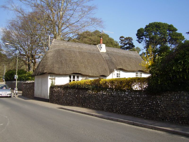
Small 2 storey thatched cob cottage with front at right angles to road
at a slightly lower level. 4 wood casements of 3 and 2 lights. Gabled
porch.
Larbi Cote forms a group with Gwydir Cottage, Cypress House, Nos 1 and
2 Cypress Place, Milestones and Town House on the opposite side of Station
Road.
Listing NGR: SY1228587591
External links are from the relevant listing authority and, where applicable, Wikidata. Wikidata IDs may be related buildings as well as this specific building. If you want to add or update a link, you will need to do so by editing the Wikidata entry.


Other nearby listed buildings
