Approximate Location Map
Large Map »
Latitude: 50.7327 / 50°43'57"N
Longitude: -2.7584 / 2°45'30"W
OS Eastings: 346574
OS Northings: 92844
OS Grid: SY465928
Mapcode National: GBR PP.0C0Q
Mapcode Global: FRA 5734.P60
Plus Code: 9C2VP6MR+3J
Entry Name: 24 and 26, South Street
Listing Date: 19 September 1975
Grade: II
Source: Historic England
Source ID: 1287382
English Heritage Legacy ID: 402524
ID on this website: 101287382
Location: Bridport, Dorset, DT6
County: Dorset
Civil Parish: Bridport
Built-Up Area: Bridport
Traditional County: Dorset
Lieutenancy Area (Ceremonial County): Dorset
Church of England Parish: Bridport St Mary
Church of England Diocese: Salisbury
Tagged with: Building
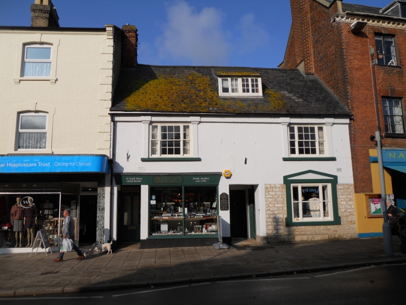
1.
5l91 SOUTH STREET
(West Side)
Nos 24 & 26
SY 4692 1/94
II GV
2.
Early C18, altered in mid C19. Stucco front. Slate roof. 2 storeys and
attics. 3-light sashes with flanking pilasters. 1 attic dormer. Tripartite
sash on ground floor with vermiculated pediment over.
Nos 16 to 26 (even) form a group, together with all the Tannery buildings.
Listing NGR: SY4657292845
External links are from the relevant listing authority and, where applicable, Wikidata. Wikidata IDs may be related buildings as well as this specific building. If you want to add or update a link, you will need to do so by editing the Wikidata entry.


Other nearby listed buildings
