Latitude: 52.9246 / 52°55'28"N
Longitude: -1.4889 / 1°29'19"W
OS Eastings: 434459
OS Northings: 336479
OS Grid: SK344364
Mapcode National: GBR PGD.QY
Mapcode Global: WHDGT.3R88
Plus Code: 9C4WWGF6+VF
Entry Name: Greyhound Inn
Listing Date: 24 February 1977
Grade: II
Source: Historic England
Source ID: 1287558
English Heritage Legacy ID: 402025
ID on this website: 101287558
Location: Derby, Derbyshire, DE1
County: City of Derby
Electoral Ward/Division: Mackworth
Parish: Non Civil Parish
Built-Up Area: Derby
Traditional County: Derbyshire
Lieutenancy Area (Ceremonial County): Derbyshire
Church of England Parish: Derby St John the Evangelist
Church of England Diocese: Derby
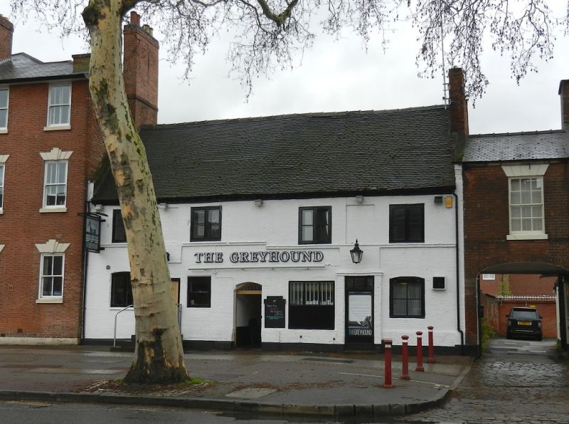
FRIAR GATE
1.
5170
(South Side)
Nos 75 and 76
(Greyhound Inn)
SK 3436 5/126
II
2.
Early-mid C19, the core probably earlier. Painted brick; 2 storeys; 4 plain casement
windows; 2 simple doorways, that to No 75 with plain rectangular fanlight; modillion
eaves. Semi-elliptical carriage arch on right-hand side.
Listing NGR: SK3445936479
External links are from the relevant listing authority and, where applicable, Wikidata. Wikidata IDs may be related buildings as well as this specific building. If you want to add or update a link, you will need to do so by editing the Wikidata entry.


Other nearby listed buildings