Approximate Location Map
Large Map »
Latitude: 52.6038 / 52°36'13"N
Longitude: -0.7963 / 0°47'46"W
OS Eastings: 481614
OS Northings: 301348
OS Grid: SK816013
Mapcode National: GBR CS8.PH5
Mapcode Global: WHFKT.QTZ7
Plus Code: 9C4XJ633+GF
Entry Name: Walling to Old Hall Grounds and Churchyard
Listing Date: 9 August 1984
Grade: II
Source: Historic England
Source ID: 1288361
English Heritage Legacy ID: 399892
ID on this website: 101288361
Location: Belton-in-Rutland, Rutland, LE15
County: Rutland
Civil Parish: Belton-in-Rutland
Built-Up Area: Belton-in-Rutland
Traditional County: Rutland
Lieutenancy Area (Ceremonial County): Rutland
Church of England Parish: Belton St Peter
Church of England Diocese: Peterborough
Tagged with: Architectural structure
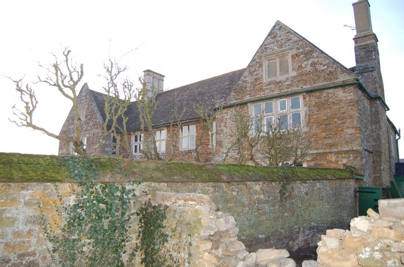
SK 80 SW BELTON IN RUTLAND CHURCH STREET (north side)
3/11 Walling to old Hall
grounds and churchyard.
GV II
Length of walling, probably C17. Coursed rubble with ashlar coping.
Listing NGR: SK8161401348
External links are from the relevant listing authority and, where applicable, Wikidata. Wikidata IDs may be related buildings as well as this specific building. If you want to add or update a link, you will need to do so by editing the Wikidata entry.


Other nearby listed buildings
