Approximate Location Map
Large Map »
Latitude: 53.1329 / 53°7'58"N
Longitude: -1.2246 / 1°13'28"W
OS Eastings: 451976
OS Northings: 359808
OS Grid: SK519598
Mapcode National: GBR 8FB.P6M
Mapcode Global: WHDFZ.5J43
Plus Code: 9C5W4QMG+55
Entry Name: Railway Viaduct
Listing Date: 17 March 1978
Grade: II
Source: Historic England
Source ID: 1288554
English Heritage Legacy ID: 391710
ID on this website: 101288554
Location: Bleak Hills, Mansfield, Nottinghamshire, NG18
County: Nottinghamshire
District: Mansfield
Electoral Ward/Division: Grange Farm
Parish: Non Civil Parish
Built-Up Area: Mansfield
Traditional County: Nottinghamshire
Lieutenancy Area (Ceremonial County): Nottinghamshire
Church of England Parish: Mansfield St Mark
Church of England Diocese: Southwell and Nottingham
MANSFIELD
SK55NW KING'S MILL LANE
924-1/3/48 (South East side)
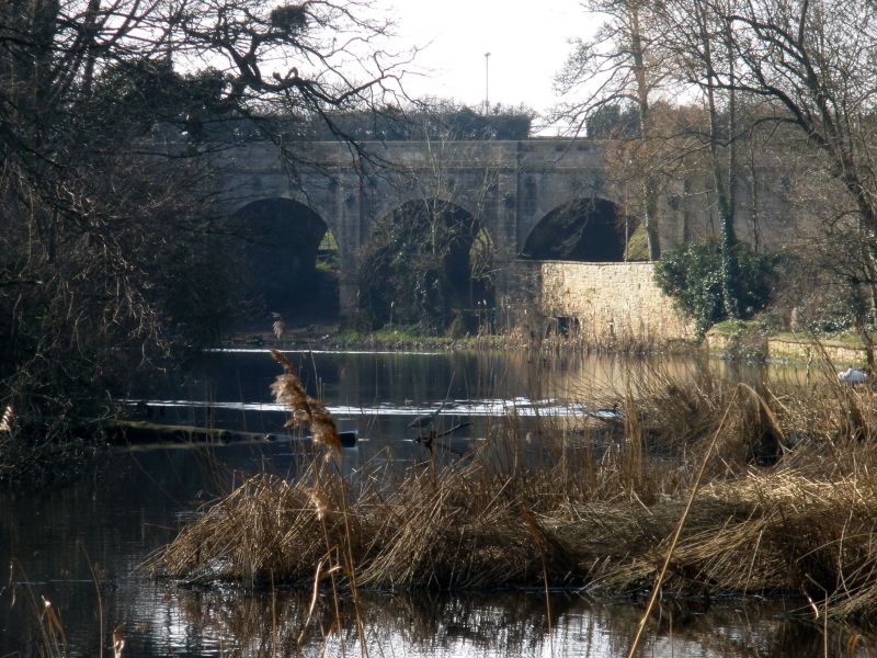
17/03/78 Railway viaduct
II
Railway viaduct. Possibly 1819, 1847, restored c1990. For the
Mansfield to Pinxton railway. Coursed squared stone with
ashlar dressings, largely renewed. 5 round arches separated by
pilaster buttresses, with wall ties and impost band. Keystone
of central arch dated 1847. Plain parapet with flat coping.
This line was constructed c1819 for pre-locomotive traffic,
and this viaduct may date from this early period, and have
been altered when locomotive traffic was introduced in 1847.
(Buildings of England: Pevsner N & Williamson E:
Nottinghamshire: Harmondsworth: 1979-: 174).
Listing NGR: SK5197659808
External links are from the relevant listing authority and, where applicable, Wikidata. Wikidata IDs may be related buildings as well as this specific building. If you want to add or update a link, you will need to do so by editing the Wikidata entry.


Other nearby listed buildings
