Latitude: 53.1436 / 53°8'36"N
Longitude: -1.1935 / 1°11'36"W
OS Eastings: 454045
OS Northings: 361016
OS Grid: SK540610
Mapcode National: GBR 8F5.YY6
Mapcode Global: WHDFZ.M7WX
Plus Code: 9C5W4RV4+CJ
Entry Name: Boundary Wall and Gates to Churchyard of St Peter and St Paul
Listing Date: 12 May 1993
Grade: II
Source: Historic England
Source ID: 1288704
English Heritage Legacy ID: 391684
ID on this website: 101288704
Location: Mansfield, Nottinghamshire, NG18
County: Nottinghamshire
District: Mansfield
Electoral Ward/Division: Portland
Parish: Non Civil Parish
Built-Up Area: Mansfield
Traditional County: Nottinghamshire
Lieutenancy Area (Ceremonial County): Nottinghamshire
Church of England Parish: Mansfield St Peter and St Paul
Church of England Diocese: Southwell and Nottingham
Tagged with: Wall
MANSFIELD
SK5461 CHURCH SIDE 924-1/6/30 (North East side) 12/05/93 Boundary wall and gates to Churchyard of St Peter and St Paul
GV II
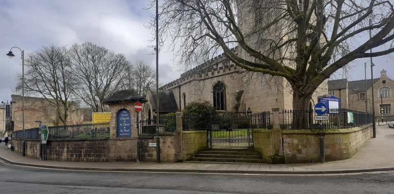
Churchyard boundary wall and gates. Dated 1832, with early C20 addition. Curved layout, flanking Church Street and Bridge Street. Approx 200m long. Coursed squared stone wall with moulded ashlar coping, formerly topped with a railing. Main gateway has steps flanked by ogee-curved walls topped with cast-iron railing. Square piers on pedestals, topped with tapered shafts of cast-iron lamps. Pair of renewed wrought-iron gates with openwork iron piers. To its left, an early C20 stone arch containing a notice board, with a swept hipped slate roof. Side gate, to Bridge Street, has similar gate and steps flanked by ogee-curved walls, with date. Included for group value.
Listing NGR: SK5404561016
External links are from the relevant listing authority and, where applicable, Wikidata. Wikidata IDs may be related buildings as well as this specific building. If you want to add or update a link, you will need to do so by editing the Wikidata entry.


Other nearby listed buildings